The Bermuda Triangle & the Devil's Sea
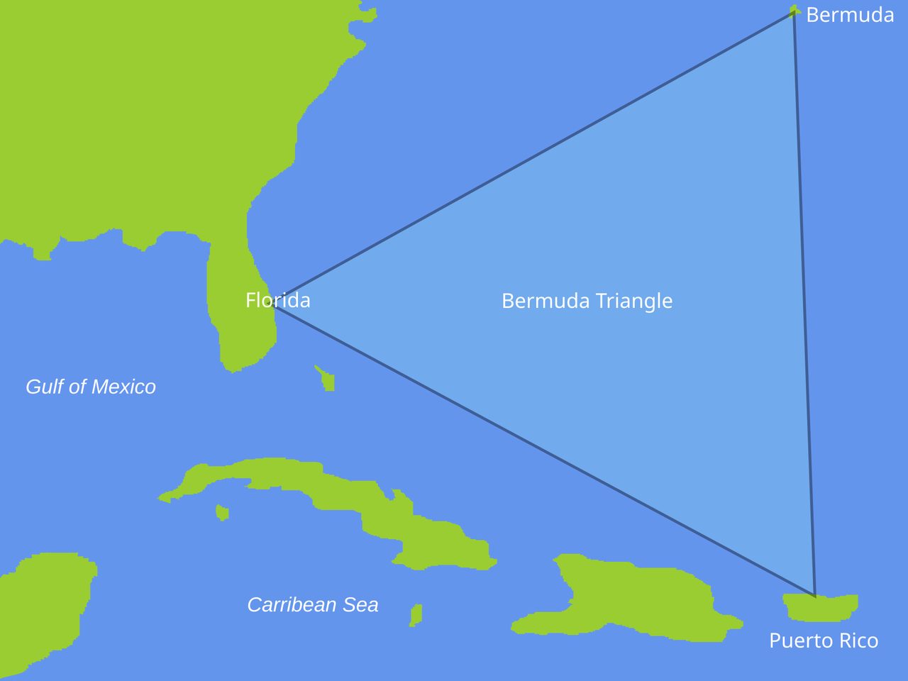
Five Navy bombers, a vanished warship, and a whole genre of disappearances at sea. The world's biggest insurance market, the U.S. Coast Guard, and one stubborn investigator took the Bermuda Triangle apart case by case and found nothing left to explain. And yet the stretch of ocean it sits in is genuinely one of the strangest places on the planet. Here is the whole file, every claim wearing its evidence.
Start not with the myth but with the water. Most of the western Bermuda Triangle sits inside the Sargasso Sea, and the Sargasso is the only sea on Earth with no coastline at all. It is held in place entirely by moving water, ringed by four great currents: the Gulf Stream on the west, the North Atlantic Current on the north, the Canary Current on the east, and the North Atlantic Equatorial Current on the south. Inside that ring the water is warm all year, roughly 20 to 28 degrees Celsius, and so clear you can see 60 to 70 meters straight down. Sailors have told frightening stories about the thick mats of Sargassum weed here, weed that supposedly grabs a ship and holds it fast, but the journals from Columbus's 1492 crossing describe it as a welcome sign of nearby land, not a trap, and there was never enough of it to slow a boat down. This is the real place the legend was built on top of, and it is stranger than the legend ever managed to be.
The legend says ships and planes vanish here without a trace, swallowed by something no map can name. It is one of the most famous mysteries in the world. It is also, by any honest reading of the evidence, solved. The people best placed to notice an anomaly, the insurers who price the risk and the Coast Guard that runs the rescues, have looked hard and found none. This dossier lays the whole case out in order, every claim wearing the tier the research file gives it, and then it does the more interesting thing: it shows you the real hazards and the real wonders of this ocean, which never needed a curse to be worth your attention.
01Where It Is, and Who Named It
There is no official Bermuda Triangle, which is the first clue. The region is conventionally drawn as the area bounded by Miami in Florida, San Juan in Puerto Rico, and the island of Bermuda, a rough triangle across the western North Atlantic. But the corners are a matter of taste. Depending on whose outline you use, it covers anywhere from about 1.3 to 3.9 million square kilometers of open ocean. A mystery zone whose own boundaries can triple depending on who is telling the story is a mystery zone worth being skeptical about.
The name is younger than most people assume. The writer Vincent Gaddis coined the phrase 'Bermuda Triangle' in a February 1964 article for Argosy magazine titled 'The Deadly Bermuda Triangle.' It went global a decade later, in 1974, when Charles Berlitz's bestseller The Bermuda Triangle turned a pulp-magazine coinage into a worldwide phenomenon. The idea, in other words, is only about sixty years old. The ocean is not.
02The Boring Numbers That Solve It
If a patch of ocean really were eating ships at an unusual rate, two groups of people would know before anyone else, because their money and their lives depend on it: the insurers who underwrite the vessels and the Coast Guard that goes out to find them. Both have said, on the record, that there is nothing unusual here.
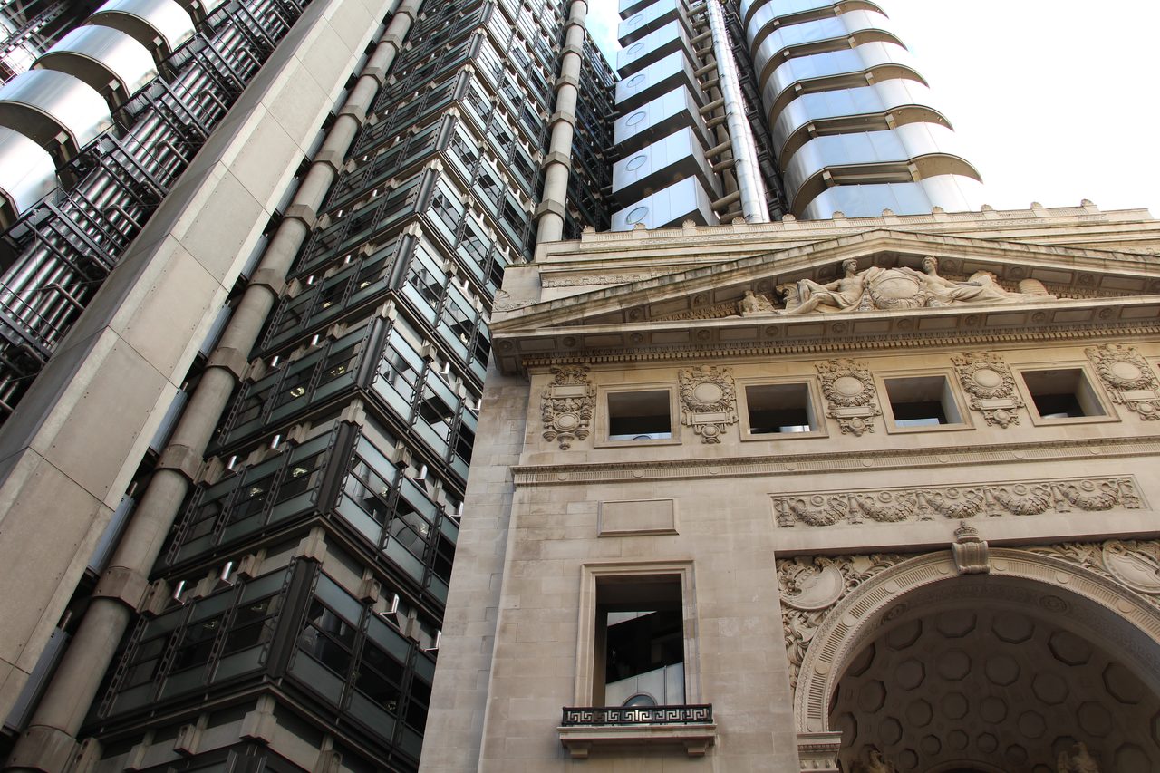
Lloyd's of London is the world's leading maritime insurance market, and pricing sea risk accurately is its entire business. Lloyd's reviewed the record and found that the Bermuda Triangle does not have a statistically higher rate of shipwrecks or losses than any other comparable stretch of ocean. If the Triangle were unusually dangerous, Lloyd's would charge more to insure a crossing. It does not, because the data does not support it.
The U.S. Coast Guard, which runs the actual search and rescue operations in these waters, reached the same conclusion. Its position is that the number of incidents in the area is not extraordinary once you account for two ordinary things: the sheer volume of traffic that passes through, and the very real natural hazards, the storms and reefs and hard currents, that this heavily used ocean throws at it.
The definitive work was simply a matter of going back and checking. In 1975 Lawrence David Kusche tracked down the original sources for every case cited by Berlitz and the rest of the Triangle literature, and his book, The Bermuda Triangle Mystery, Solved, took the legend apart one case at a time. What he found was not a cover-up but carelessness. Many of the famous incidents had happened outside the Triangle's boundaries entirely. Many involved severe weather that the dramatic retellings simply left out. Several ships and aircraft written up as vanished had in fact been found, but the correction never caught up to the story. A few incidents had been fabricated outright, or stitched together from separate events. And the rest were the perfectly ordinary losses you would expect in one of the busiest, most weather-beaten shipping and flying corridors on Earth, reframed as something spooky.
03Every Objection, In One Table
The research file behind this article carries its own quick-reference summary, six of the most common Triangle claims set against what the evidence actually says. It is the whole debunking on one screen.
| The Claim | What The Evidence Says |
|---|---|
| An unusual number of ships and planes disappear here. | Lloyd's of London and U.S. Coast Guard data show no statistical anomaly. The losses match what any comparable, heavily trafficked ocean sees. |
| They vanish without a trace, leaving no wreckage. | The water is deep and the Gulf Stream is fast. Between them they scatter and carry off debris naturally, no curse required. |
| Compasses malfunction in the Triangle. | The agonic line runs through the area, so a compass points to true north instead of magnetic north. It is well known, easily corrected, and no secret to any trained navigator. |
| Even modern, well-equipped vessels still disappear. | Set against the enormous traffic, the losses are proportional and ordinary. Busy oceans lose ships everywhere. |
| Methane eruptions from the sea floor sink ships. | The physics works in the lab, but no specific Triangle disappearance has ever been linked to a methane eruption. |
| The government covers up what really happens. | Most incidents have publicly available Coast Guard and Navy reports. The records are open. |
04Flight 19
Two cases carry most of the legend's weight, so they deserve a close look. The first is the one that arguably started the whole thing.
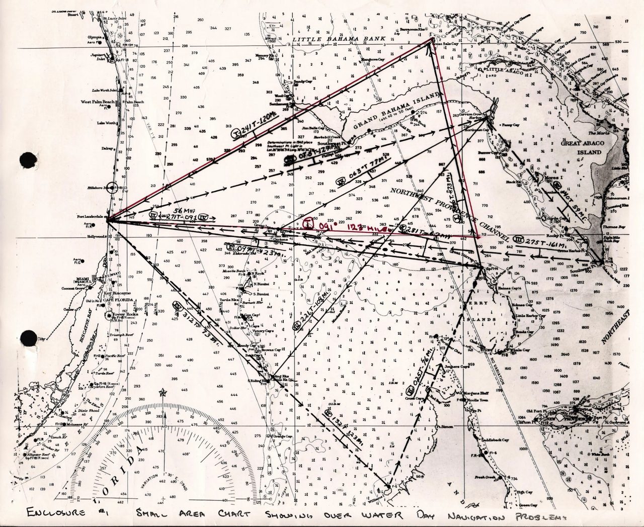
On December 5, 1945, five TBM Avenger torpedo bombers took off from Fort Lauderdale, Florida, on a training flight and never came back. This is Flight 19, the founding legend of the Bermuda Triangle. The U.S. Navy Board of Investigation that examined the loss did not conclude anything supernatural. It found that the flight leader, Lieutenant Charles Taylor, had become disoriented. He believed his aircraft were over the Florida Keys, to the south, when they were actually over the Bahamas, to the east. Convinced he was in the wrong place, he led the flight further east, out over open ocean, chasing a coastline that was behind him, until the planes ran out of fuel and went down into the sea.
Then the story got its second act. One of the two Martin Mariner flying boats sent out to search for Flight 19 also disappeared. That sounds like the Triangle claiming its rescuers, until you know the aircraft. The Martin Mariner had a known and documented design flaw: fuel-tank vapor that could build up and explode. A Mariner vanishing in a burst over the water is not an unsolved mystery. It is a fatal engineering defect doing exactly what such a defect does.
05The USS Cyclops
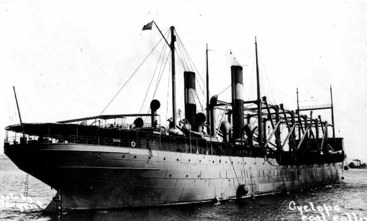
One case in the whole legend is a genuine mystery, and this is it, though the mystery is a maritime one and not a paranormal one. In March 1918 the USS Cyclops, a Navy collier, sailed from Barbados toward Baltimore with 309 crew and was never seen again. No wreck, no distress call, no survivors. The plausible explanations are all mundane and all serious: she was overloaded with heavy manganese ore and may have suffered a structural failure, she may have been caught and capsized in a storm, or, since this was the First World War, she may have been lost to German submarine activity. No one has ever proven which. What matters for the Triangle is the date. The Cyclops vanished in 1918, more than forty years before anyone wrote the words Bermuda Triangle. It is a real, unsolved loss at sea, of the kind that has happened in every ocean in every era, and it was retrofitted into a legend that did not yet exist.
06The Real Hazards, No Curse Required
Here is where the story gets genuinely interesting, because saying the Triangle is not cursed is not the same as saying this ocean is safe or dull. It is neither. Three real phenomena get pulled into the myth, and all three are worth understanding on their own terms. None of them needs anything paranormal, and none of them is unique to this particular triangle of water.
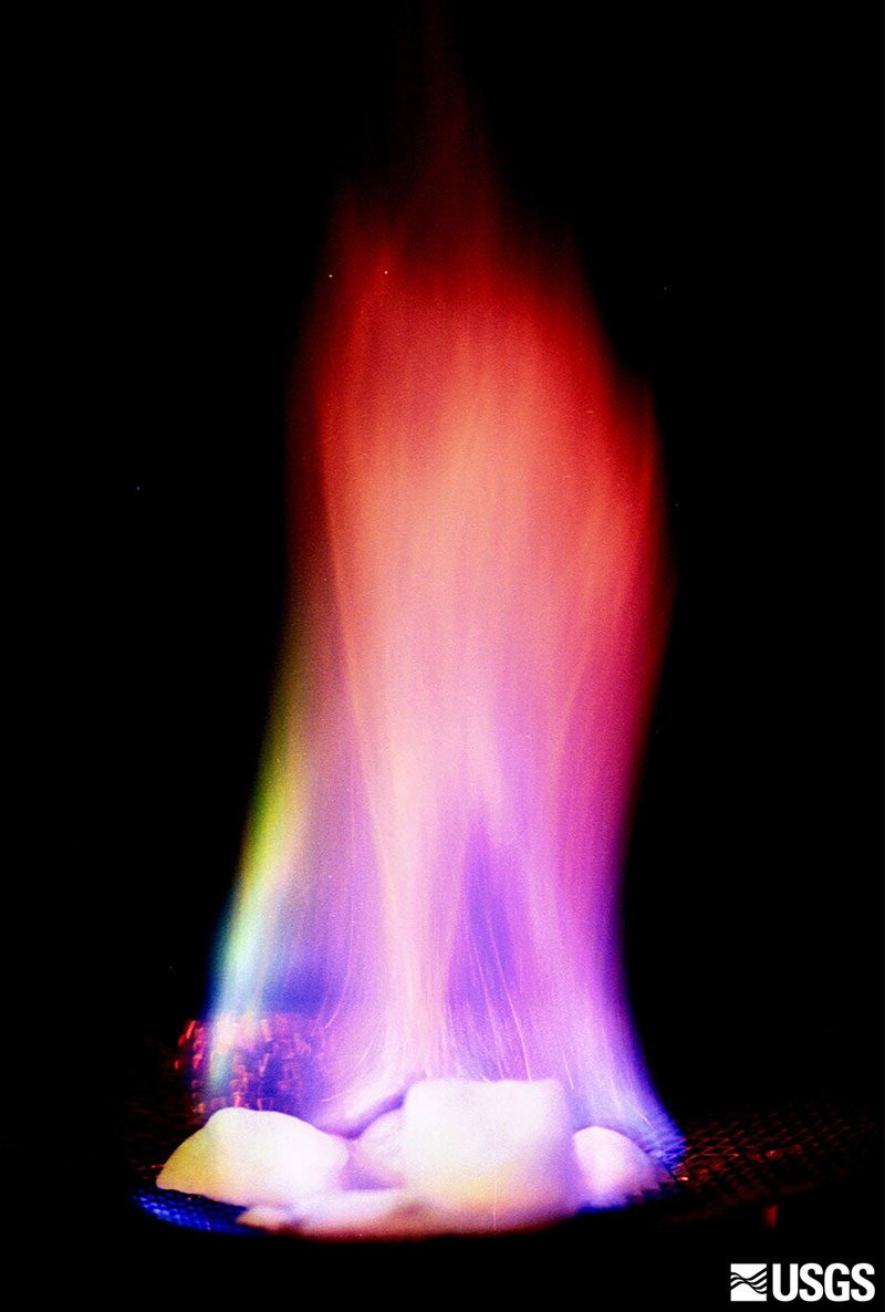
Methane hydrate. Frozen deposits of methane gas, locked into an ice-like crystal on the sea floor, sit in large quantities along the continental shelves of the western Atlantic. The hypothesis is that a sudden release of that gas could froth the water with bubbles, drop its density, and let a ship fall straight through a patch of ocean that has briefly stopped being buoyant enough to hold it, and that the rising gas cloud could form an explosive mixture that reaches an aircraft engine overhead. This is not fantasy. In 2003 a laboratory at Monash University, in work by David May and Joseph Monaghan, showed that a stream of methane bubbles really can lower water density enough to sink a scale model ship. The physics is sound. The catch is that no actual Bermuda Triangle disappearance has ever been tied to a methane eruption, and large seafloor methane releases on the scale you would need are extremely rare in the modern era. It is a real mechanism still in search of a real victim.
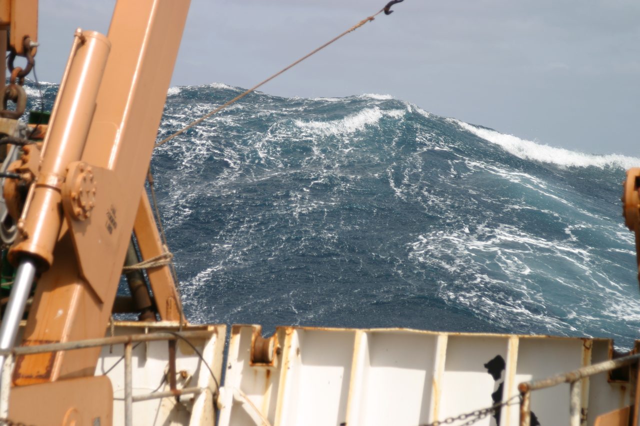
Rogue waves. For a long time sailors' accounts of sudden walls of water, far taller than the surrounding sea, were dismissed as exaggeration. Then the satellites caught them. The European Space Agency's MaxWave project confirmed that rogue waves, waves that can top twice the surrounding significant wave height, happen far more often than the old models allowed. The western North Atlantic is a good place to make them: where the powerful Gulf Stream runs up against colder water, the clash of currents can raise the odds of one forming. A rogue wave can overwhelm and sink a vessel in seconds, which is exactly how you get a disappearance with no distress call and no debris. This is genuinely one of the ways the sea kills ships. It is just not special to the Triangle, and it needs no explanation beyond fluid dynamics.
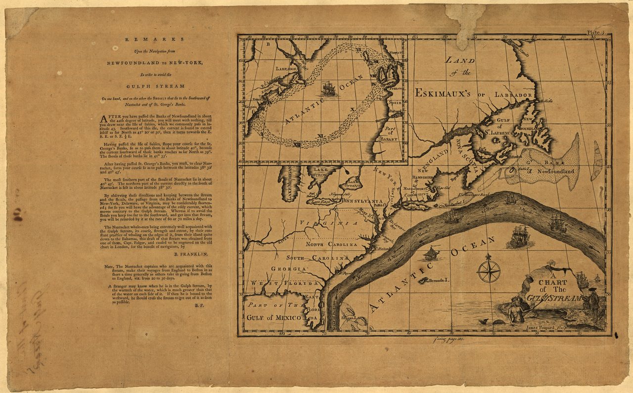
The compass quirk. This one is true and completely undramatic. There is a line on the Earth, the agonic line, along which a magnetic compass points to true north and magnetic north at the same time, because the difference between the two falls to zero. For a long time that line ran through the Bermuda Triangle, which is where the compasses-go-haywire stories come from. But every trained navigator on Earth knows about magnetic variation and corrects for it as a matter of routine, the way you account for a crosswind. It has never been a plausible cause of a serious navigation error in the modern age. And here is the final deflation: the agonic line drifts over time, and it has since moved west. It does not even pass through the Triangle anymore.
07The Claims That Rest On Almost Nothing
Below the solid science sits a thinner layer of claims. They are not quite fringe, and this article does not mock them, but they rest on very little, and the tiers say so.
The electronic fog. In 1970 a pilot named Bruce Gernon reported flying through a strange, tunnel-like cloud over the Bahamas, and described his instruments going wild and time itself seeming to stretch and compress. He has told the story ever since. The problem is that the story is all there is: a single first-person account with no instrument recordings, no second aircraft, no data of any kind to corroborate it. Meanwhile the tropical western Atlantic is a factory for violent, disorienting weather, the microbursts and waterspouts and towering cumulonimbus storms, any of which can produce a genuinely frightening and strange experience in a cockpit without a shred of the paranormal. Gernon's account is real in the sense that he really tells it. It is evidence of nothing beyond itself.
The Devil's Sea. The Triangle has a supposed Pacific twin, a stretch of water south of Tokyo that the Japanese call Ma no Umi, the Devil's Sea, often billed as an eastern counterpart where ships also vanish. It falls apart the same way, and here the debunking evidence is unusually solid. When Kusche looked into it, he found that Japanese authorities had recorded no unusual number of losses in the area at all. And the incidents most often cited, a cluster of fishing-vessel losses in the 1950s, were attributed to documented volcanic activity at the Myojin-sho submarine volcano. The dangerous water was real. The danger was a volcano, not a curse.
08The Fringe, Refused
And then there is the material this article will simply not entertain, because there is nothing underneath it to entertain.
The Atlantean fire crystals. A line of claims descended from the psychic Edgar Cayce holds that giant 'fire crystals,' or 'tuaoi stones,' relics of a sunken Atlantis, lie on the sea floor and fire off energy that disrupts ships and planes. There is no physical evidence for this, no geological evidence, and no archaeological evidence. There is no Atlantis on that sea floor, and there are no crystals. This is not a theory with weak support. It is a story with none.
Aliens and interdimensional portals. The other fringe branch explains the disappearances as extraterrestrial abduction, or as ships and planes slipping through a doorway into another dimension. These carry no evidentiary support of any kind, and they have a second problem stacked on top of the first: they are answers to a question that has already been answered. The documented incidents already have natural and human explanations, the disorientation and the weather and the engineering flaws and the deep water and the ordinary bad luck at sea. Reaching past all of that for a portal is not bold. It is just skipping the homework.
Fast Facts
- The Corners
- Conventionally Miami, the island of Bermuda, and San Juan in Puerto Rico. There is no official outline, and estimates of the area run from about 1.3 to 3.9 million square kilometers.
- The Name
- Coined by Vincent Gaddis in Argosy magazine in February 1964, and made globally famous by Charles Berlitz's 1974 bestseller The Bermuda Triangle.
- The Verdict From The Pros
- Lloyd's of London finds no elevated loss rate, and the U.S. Coast Guard calls the number of incidents unexceptional for the traffic and the weather.
- The Audit
- Lawrence Kusche's 1975 book The Bermuda Triangle Mystery, Solved traced every famous case back to its sources and found weather, error, or invention.
- Flight 19
- Five Avenger bombers lost on December 5, 1945, after their leader mistook the Bahamas for the Florida Keys and flew east until the fuel ran out.
- USS Cyclops
- A Navy collier lost with all 309 crew in March 1918, decades before the Triangle was named. A real mystery, not a paranormal one.
- The Real Hazards
- Methane hydrate physics (proven in the lab), rogue waves (confirmed by satellite), and the agonic-line compass quirk. All genuine, none unique to the region.
- The Sea It Sits In
- Mostly the Sargasso Sea, the only sea on Earth defined by currents rather than coasts, where eels from two continents spawn and no one has ever watched them do it.
So Is The Bermuda Triangle Real?
The debunking is solid, and it is the strongest part of the whole story. Lloyd's of London finds no elevated loss rate, the Coast Guard calls the incident count ordinary, and Kusche's case-by-case audit dismantled the famous disappearances one at a time. Flight 19 was a disoriented flight leader heading east until empty, and its lost search plane was a known fuel-tank defect. The USS Cyclops was a real and heartbreaking loss, but an ordinary kind of loss, and it happened before the legend even existed. As a zone where the laws of nature break down and things vanish without cause, the Bermuda Triangle is not real. That is not a hunch. It is what the people who insure and rescue these ships have concluded from the data.
The ocean itself, though, is no myth. Methane hydrate really can sink a model ship in the lab, rogue waves are real and satellite-confirmed and this is a good stretch of sea for building them, and the agonic line really did once send compasses to true north here. Every one of these is genuine, interesting physics. And every one comes with the same honest asterisk: not a single documented disappearance has ever been pinned on any of them, and none is special to this triangle rather than to oceans in general.
A couple of claims sit lower, kept there on purpose. Bruce Gernon's 'electronic fog' is one man's vivid, uncorroborated story, readily explained by the region's ordinary violent weather. The Pacific Devil's Sea is billed as a twin mystery but dissolves the same way, with the bonus that its debunking is airtight: the famous 1950s losses were the Myojin-sho volcano, not a curse.
And two claims get refused outright, because the evidence for them is zero. Edgar Cayce's Atlantean 'fire crystals' have no physical, geological, or archaeological basis whatsoever. Alien abduction and interdimensional portals have none either, and they ignore the plain natural and human explanations already sitting in the record. These are not underdog theories fighting a closed-minded establishment. They are answers to a mystery that turned out not to be one.
So the file closes, and it closes clean. The Bermuda Triangle was never the mystery. The sea it sits in still is. In the clear blue water of the Sargasso, European and American eels arrive from thousands of kilometers away, from two different continents, to spawn in the deep and die, and in more than a century of searching no scientist has ever once watched a single eel do it. Ships do not vanish here without a trace. But the ocean is still keeping secrets, better ones, in plain sight. So which is the question actually worth losing sleep over: why do vessels sometimes sink in the busiest, stormiest sea lanes on the planet, or how does the whole Atlantic keep doing a thing right in front of us that no human being has ever managed to see?
Sources & further reading
Everything above is drawn from our research library on Theories of Anything, which is where we worked from. The papers, reports and primary records listed beneath them are where you can check us independently.
Image credits
- Bermuda Triangle boundary map by Wikimedia Commons user P,TO 19104, after a Spanish-language original by Danilo94, via Wikimedia Commons. Dual-licensed: Creative Commons Attribution-Share Alike 3.0 Unported, and GNU Free Documentation License Version 1.2 or later Source.
- Flight 19 Navigation Problem No. 1 course map, 1945 U.S. Navy, from the U.S. National Archives, via Wikimedia Commons. Public domain Source.
- USS Cyclops, circa 1913 photograph by Sargent, U.S. Naval History and Heritage Command (Photo #NH 101063), via Wikimedia Commons. Public domain (Creative Commons Public Domain Mark 1.0) Source.
- Burning methane hydrate United States Geological Survey, via Wikimedia Commons. Public domain Source.
- A Chart of the Gulf Stream, Poupard's 1786 engraving engraving by James Poupard, 1786, after Timothy Folger and Benjamin Franklin's chart first published in 1770; Library of Congress, Peter Force Map Collection, via Wikimedia Commons. Public domain Source.
- A large wave astern of a NOAA research ship, Atlantic Ocean, 2005 personnel of NOAA Ship Delaware II, via the NOAA Photo Library and Wikimedia Commons. Public domain Source.
- The Lloyd's building, Lime Street, London photograph by Fred Romero, via Wikimedia Commons. Creative Commons Attribution 2.0 Generic Source.
- Card crop of Bermuda Triangle boundary map by Wikimedia Commons user P,TO 19104, after a Spanish-language original by Danilo94, via Wikimedia Commons. Dual-licensed: Creative Commons Attribution-Share Alike 3.0 Unported, and GNU Free Documentation License Version 1.2 or later Source.


.jpg)