Ley Lines & the Earth Grid
Draw a ruler across a map of England and you will hit a church, a burial mound, a standing stone, an old hillfort, all in a line. Alfred Watkins noticed exactly that in 1921 and reached a mundane conclusion: these were ancient trade routes, not magic. Then in 1969 someone bolted an invisible energy grid onto his idea, and the argument has been stuck between mysticism and mockery ever since. Both camps are missing the more interesting truth. There are real magnetic anomalies under real stones. There is one alignment the coincidence math struggles to explain. There is a striking global correlation whose own discoverer warns you not to over-read it. And there are three living systems, in Australia, China, and the Andes, that did exactly what the believers imagine and left the receipts. Here is the whole grid, tier by tier.
The phrase 'ley line' now carries two completely different meanings, and almost every argument about the subject comes from mixing them up. One is a testable claim about geography: that ancient sites fall along straight lines more often than chance allows. The other is a metaphysical claim about energy: that those lines are channels of an invisible earth force you can feel, dowse, and map onto a planetary grid. The first is a matter for statistics. The second is a matter for physics, and physics has looked. Keeping them apart is the only way to see what actually survives scrutiny, and a surprising amount does.
01The Man Who Started It Meant Roads
Start with the man who started it, because he would be appalled at what his idea became. Alfred Watkins was a Herefordshire businessman and one of the finest photographers of his day; the Royal Photographic Society gave him its Progress Medal in 1910. He came to archaeology late and as an amateur. In 1921, near a place called Blackwardine in Herefordshire, he looked at the landscape and saw a web of straight lines connecting ancient sites. He first laid the idea out that September, to the Woolhope Naturalists' Field Club of Hereford, and put it in print the next year in Early British Trackways, before the book that made it famous.
Watkins' actual proposal was thoroughly down to earth. He noticed that ancient features, burial mounds, standing stones, hillforts, and the medieval churches that were so often built on older sacred ground, appeared to line up on straight tracks across the English countryside. His explanation was practical, not mystical: these were the remains of prehistoric trade and travel routes, sighted line by line across the land. He called them 'leys,' from the Anglo-Saxon 'lea' for cleared ground, and set the whole system out in his 1925 book The Old Straight Track. There was no energy in it anywhere. Just people, walking in straight lines to get somewhere.
And on its own terms the idea is not crazy. Some genuine alignments do exist. Watkins' practical reading, that a straight sighted path is an efficient way to cross unmapped country, is reasonable. It is also, frustratingly, very hard to test, because a straight line is exactly what you get both from deliberate route-building and from pure chance, and telling those two apart is the whole problem the rest of this file circles.
02The Energy Nobody Asked For
For forty-four years that was the theory: old roads, drawn straight. Then in 1969 the writer John Michell published The View Over Atlantis and changed the subject entirely.
Michell took Watkins' practical trackways and reimagined them as channels of 'earth energy,' an invisible force pulsing through the landscape and pooling at sacred sites. This is the version most people mean today, and the timeline is worth stating flatly: the mystical layer was added to ley lines forty-four years after Watkins, by a different man, for entirely different reasons. Watkins never proposed it, and there is no evidence for it. The specific claim that ley lines are the surviving map of a lost advanced civilization, a grid built by people who understood forces we have forgotten, has nothing behind it at all. [DEBUNKED]
03Lines By Chance, And One That Isn't
Here is the skeptics' case in one number, and it is the strongest argument in the whole subject. Britain has roughly forty thousand recorded archaeological sites. At that density, straight lines connecting four or more of them are not remarkable, they are inevitable. When statisticians like Robert Forrest ran the test, scattering random points across a simulated map and counting the alignments, the random maps produced just as many 'ley lines' as the real one. The conclusion is uncomfortable for believers and hard to dodge: the vast majority of claimed ley lines do not exceed what chance alone would hand you. A ruler laid across a dense enough field of dots will always find a line. That the dots line up does not mean the dots meant anything.
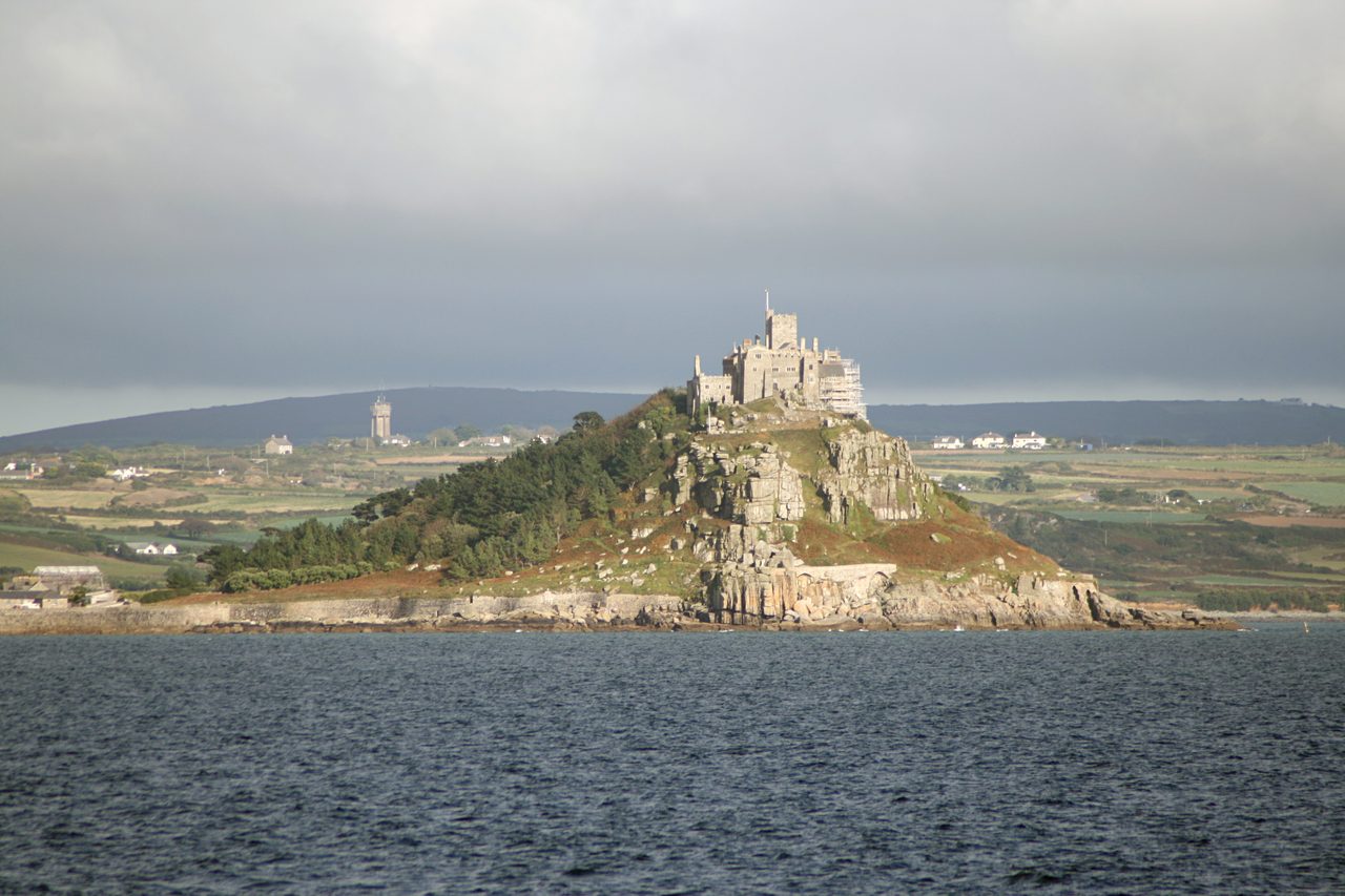
But the skeptics left a door open, and one case walks through it. The St. Michael's Line runs about three hundred and fifty miles across southern England, from St. Michael's Mount off the coast of Cornwall, through Brentor, Glastonbury, and Avebury, to Bury St. Edmunds and on to Hopton in Norfolk. It is the most cited alignment in the subject, and unlike most it has a feature that raw chance does not obviously explain.
The feature is thematic, not just geometric. A striking number of the churches strung along the line are dedicated to the same saint, St. Michael, the dragon-slayer. A single straight line of sites is easy to dismiss as coincidence. A straight line whose churches keep honoring the same specific saint is harder to wave away, because now you need a reason for the pattern, not just the geometry. The file gives the counter its due, though: church dedications may simply follow an older route that already existed for ordinary reasons, and 'on the line' is a generous phrase that hides a lot of margin. It is the strongest case in the subject. It is not a proven one.
04Real Anomalies Under Real Stones
This is where the subject stops being folklore and starts being geophysics. Earth's magnetic field is not uniform. It is riddled with anomalies at every scale, mapped in detail by agencies like NOAA, because the rock underfoot is magnetic in its own right. Granite is the clearest case: it is shot through with tiny magnetite crystals, which makes granite bedrock measurably magnetic. And a great many megalithic monuments are either built from granite or planted directly on it.
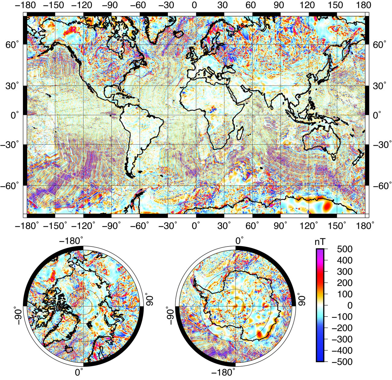
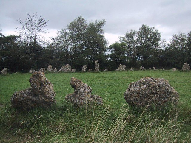
You can measure it at a specific ring of stones. At the Rollright Stones in Oxfordshire, the circle known as the King's Men, instruments have recorded a genuine magnetic anomaly right at the boundary of the ring, documented by Don Robins in his 1985 book Circles of Silence. The stones sit where the field does something odd. That much is not in dispute.
And ancient structures can bank a magnetic record without anyone intending it. A 2023 study in the Proceedings of the National Academy of Sciences read the faint magnetism frozen into thirty-two inscribed clay bricks from ancient Mesopotamia and found the fingerprint of a massive, still-unexplained surge in Earth's field. Because each brick was stamped with a king's name, the researchers could date it, and the sharpest spike lines up with the reign of Nebuchadnezzar II, from 604 to 562 BCE. Baked mud, it turns out, is a tape recorder for the planet's magnetism, and this is a real, independently confirmed study, not a fringe one.
Now the hard part, and the place careless writers go wrong. Every sentence above is Tier 1, measurable, repeatable fact. The magnetic anomalies are real. What is not established is the leap that usually follows: that the ancient builders knew about these fields and deliberately chose magnetically active ground for their monuments. That reading sits no higher than Tier 2 to 3, a plausible hypothesis with no proof behind it. Sitting on an anomaly and selecting for one are different claims, and only the first is demonstrated. A sibling dossier in this wing takes the instruments themselves much further, the magnetometer surveys and the tectonic-strain arguments; here the point is only to keep the fact and the interpretation from being welded together, which is exactly the welding the whole 'earth energy' story depends on.
05When Sacred Sites Sit On Active Ground
The magnetism is one thread of a broader, genuinely documented pattern. Site by site, an unusual number of the world's sacred places sit on geologically active or unusual ground. Springs and water sources at Delphi, Bath, and Lourdes. Volcanic and seismic activity, from Yellowstone to the ethylene fissure beneath Delphi. Granite, with its piezoelectric and magnetic properties, at Carnac and at the quarry that gave Stonehenge its bluestones. Quartz, which generates a voltage when squeezed, packed into standing stones the world over. Fault lines, which produce measurable electromagnetic effects, under sacred sites on every continent. Each of these correlations is real and separately recorded.
But notice the honest word: correlation. Each pairing is documented on its own. What nobody has actually done is the hard statistical work of asking whether the whole set adds up to a deliberate pattern, whether ancient builders were somehow selecting geologically restless ground on purpose, or whether striking places are simply the kind of places any culture would sanctify, and striking places are often geologically odd for the very reasons that make them striking. Until that test is run, and it has not been, the pattern is a suggestive list, not a proven design.
06Carnac: The Alignment You Can Touch
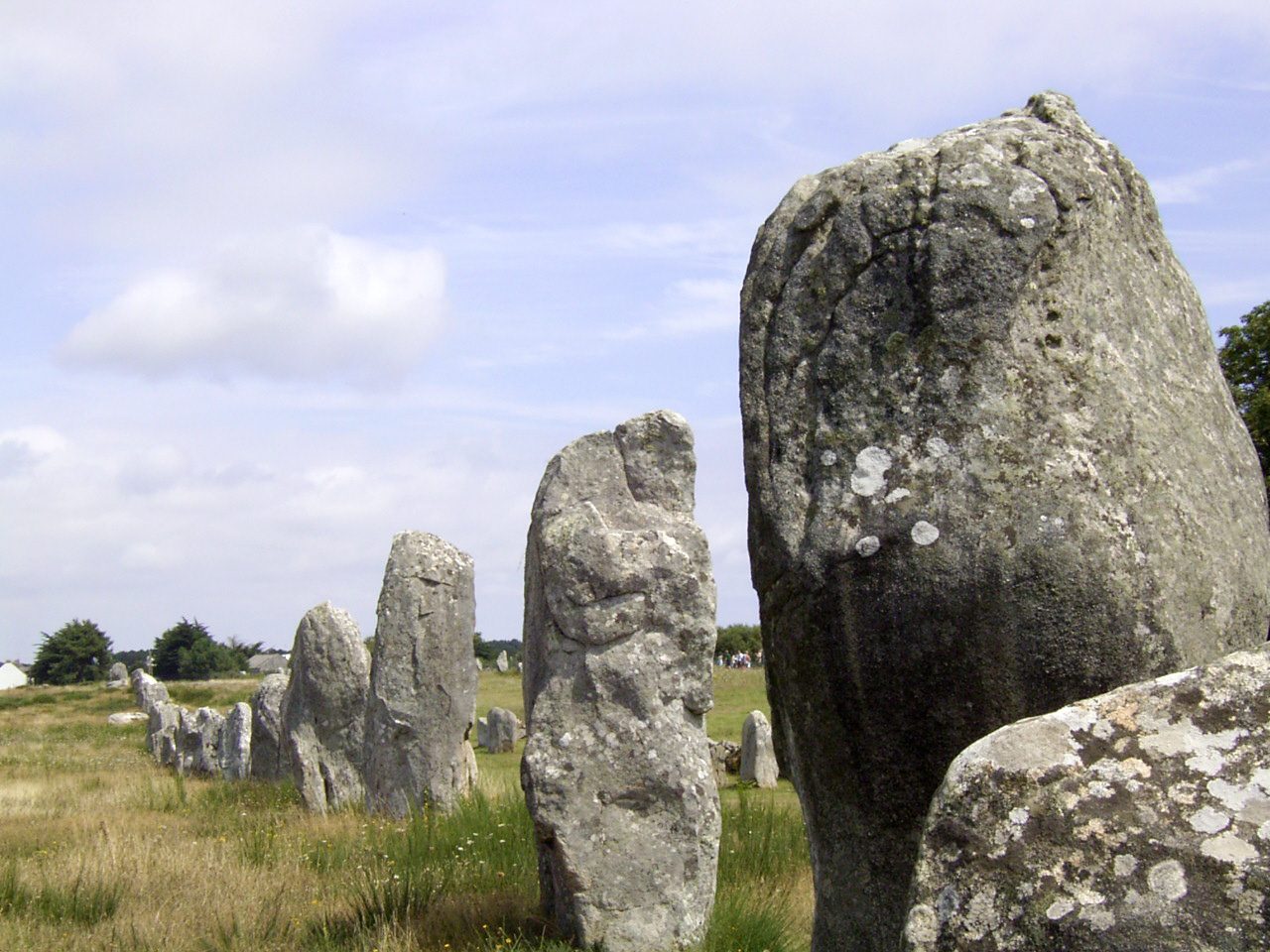
For all the argument about invisible lines, there is one place where the alignment is made of granite you can put your hand on. Near Carnac, in Brittany, roughly three thousand standing stones march in rows across more than four kilometers of ground, raised between about 4500 and 3300 BCE. They fall into three great groupings: Menec, with 1,099 stones in eleven rows; Kermario, with 1,029 stones in ten rows; and Kerlescan, with 540 stones in thirteen. The stones shrink as they go, from nearly four meters tall at the western end down to about 0.6 meters at the east, a gradient far too consistent to be an accident, and the rows are punctuated by dolmens, burial mounds, and a great stone circle at Menec's western tip.
What the rows are for is the open question. Alexander Thom measured them meticulously and argued they were aimed at astronomical events, the summer solstice sunrise, the extremes of the moon's standstill cycle. His work is influential and genuinely rigorous, and it is also contested: the rows are not perfectly straight, they bend to follow the land, and no consensus has ever formed on whether they track the sky, the terrain, or something we have not guessed. Thom may be right. He is not confirmed.
But hold on to the thing that makes Carnac different from almost everything else in this file. The stones are there. Nobody has to argue about whether the alignment exists, you can walk its length. Here the mystery is not existence but purpose, which is a far healthier place for a mystery to live.
07Nazca: Function, Not Runways
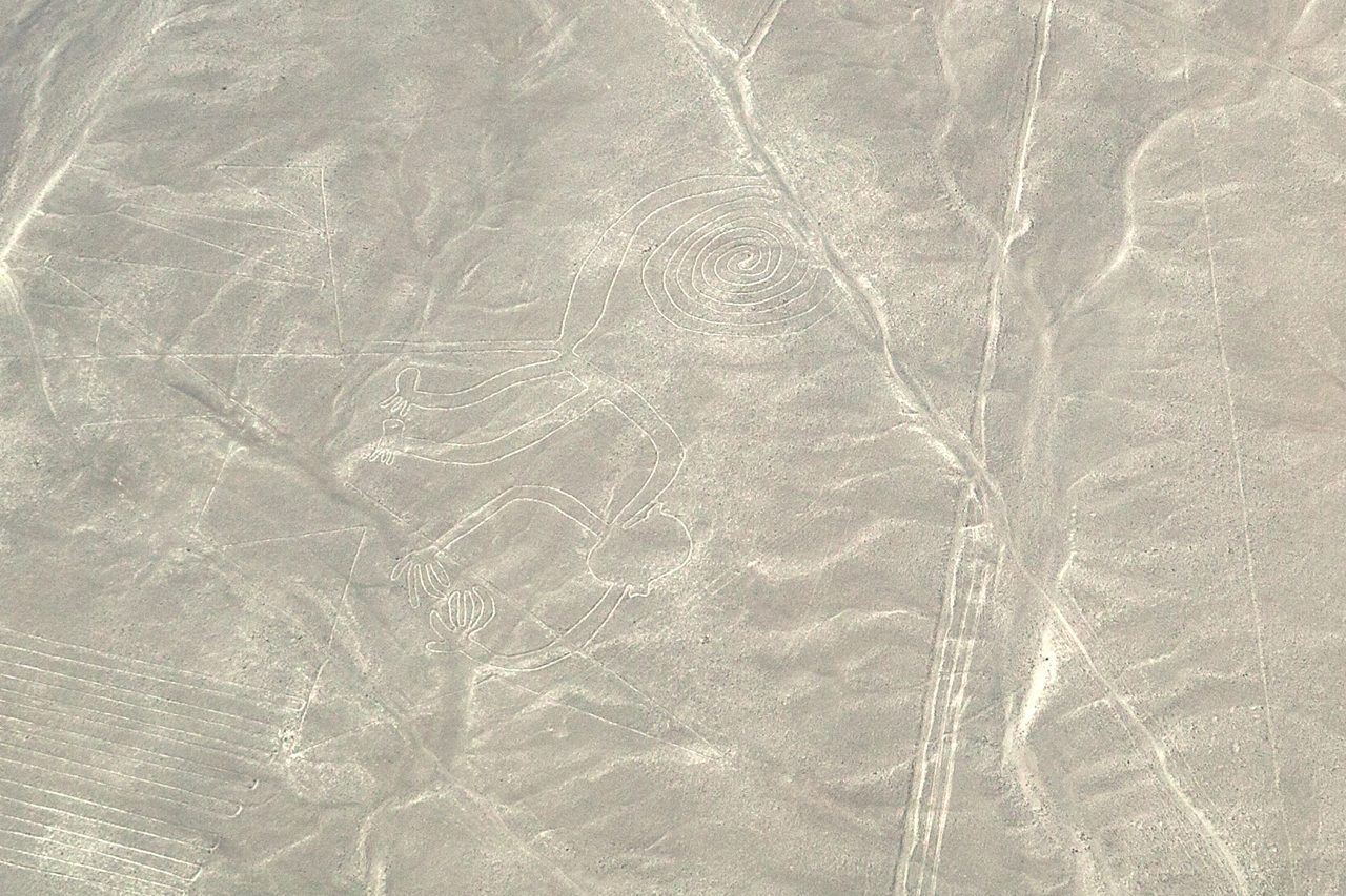
Across an ocean from Carnac lies the other alignment everyone has heard of. On the Nazca Pampa of southern Peru, the Nazca culture cut roughly fifteen hundred geoglyphs into the desert between about 500 BCE and 500 CE: dead-straight lines running for ten kilometers and more, vast trapezoidal clearings, and the famous animals, the hummingbird, the monkey, the spider, the condor. The technique was simple and the preservation is a gift of the climate. They scraped off the dark, oxidized surface stones to reveal lighter ground below, and it almost never rains there to erase the work.
Three serious theories compete over what the lines were for, and all three are grounded in the actual Nazca. Maria Reiche argued they encoded an astronomical calendar, with lines pointing to solstices and other celestial events. Her reading is partially supported; some lines do point at the sky, but plenty align to nothing in it.
Anthony Aveni, whose account the file rates most highly, showed that many lines radiate outward from shared centers, ray centers strikingly like the Andean ceque systems further south, and tied them to water management, ritual procession, and the organization of Nazca society. In a desert, lines that lead to water and order who walks them are not mysterious, they are infrastructure.
Johan Reinhard connected the lines to the worship of mountain deities and the search for water, which in that landscape is close to the same thing. Three theories, all rooted in a real culture with real needs.
And then there is the fourth idea, the one that made Nazca famous for the wrong reason. In 1968 Erich von Daniken declared the lines were 'landing strips for alien spacecraft.' It fails on contact with the ground, literally: the Nazca soil is soft and could never have borne a vehicle, the figures are meant to be read and can barely be made out from ground level where a landing craft would sit, and every feature is fully accounted for by known Nazca culture. This file does not mince words about it. In its own assessment, the alien-runway claim is the single most debunked claim in the entire project. [DEBUNKED]
08Cusco: The Line Network That Was Real
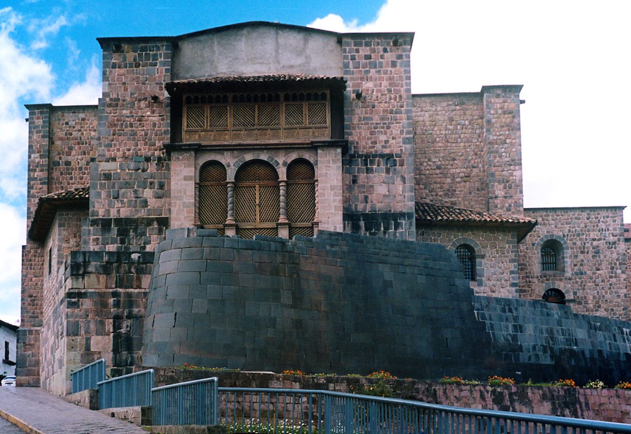
If you want a culture that really did organize its sacred sites along lines, you do not need to imagine one. You can read its blueprint. The Inca capital of Cusco was built around forty-one lines, called ceques, radiating outward from a single center: the Coricancha, the Temple of the Sun. Each ceque strung together a series of huacas, sacred points that could be a spring, a boulder, a building, a hill, or a tomb, and together the system tied roughly three hundred and twenty-eight huacas into one net. It is not a theory reconstructed from ruins. It was written down, by the chronicler Bernabe Cobo, in 1653, and confirmed since by modern archaeology.
The ceques were a working machine for running a society. They carved the landscape into zones of responsibility, with different kin groups, the ayllus, each charged with maintaining particular lines and their shrines. And they kept time: specific huacas marked where the sun rose or set on the solstices and other calendar dates. Brian Bauer's fieldwork later walked the ground and confirmed many, though pointedly not all, of the ceque identifications an earlier generation had proposed.
This is the file's own designated best-documented case, and it earns the title. The ceque system proves, on paper and on the ground, that at least one civilization deliberately built a network of lines connecting sacred sites and loaded it with astronomical, social, and ritual meaning. But it also draws a distinction that matters for the whole subject. The ceques are radial: they fan out from one center, the Coricancha, like spokes. Watkins' leys are parallel straight lines scattered across a whole landscape. Those are genuinely different geometries, not the same idea in two costumes, and blurring them is how a real Inca system gets used to prop up an unproven English one.
09The Same Impulse, Six Cultures
Step back far enough and the impulse looks universal. Culture after culture has drawn lines through its sacred landscape, and the versions are worth laying side by side, because they are not equally real, and the differences are the whole point.
| Tradition | Culture | The Idea | Reality Check |
|---|---|---|---|
| Ley lines | England (Watkins) | Straight alignments of ancient built sites | Mostly chance at British site density; a few cases such as St. Michael's Line may exceed it |
| Long mai (dragon veins) | China (feng shui) | Channels of qi running along mountain ridges and watercourses | A real, state-level practice still used today; qi itself has no physical basis |
| Songlines (Dreaming tracks) | Aboriginal Australia | Sung routes linking sacred sites, water, and law across thousands of km | A verified navigation and knowledge system, not earth energy |
| Fairy paths | Celtic Britain and Ireland | Lines between forts and mounds, traditionally never built on | Folk tradition; no documented physical network |
| Ceques | Inca (Cusco) | 41 lines radiating from the Coricancha to roughly 328 huacas | Archaeologically documented and confirmed on the ground |
| Sacbeob | Maya (Mesoamerica) | Raised causeways between cities | Physically real roads, not theoretical alignments |
Read down the last column and the lesson is clear. Some of these are folklore, some are documented practice, and two are not lines of force at all but engineering you can put your feet on. So we take three of the living ones in turn, because they answer the ley-line question better than any argument about England ever will.
10Feng Shui's Dragon Veins
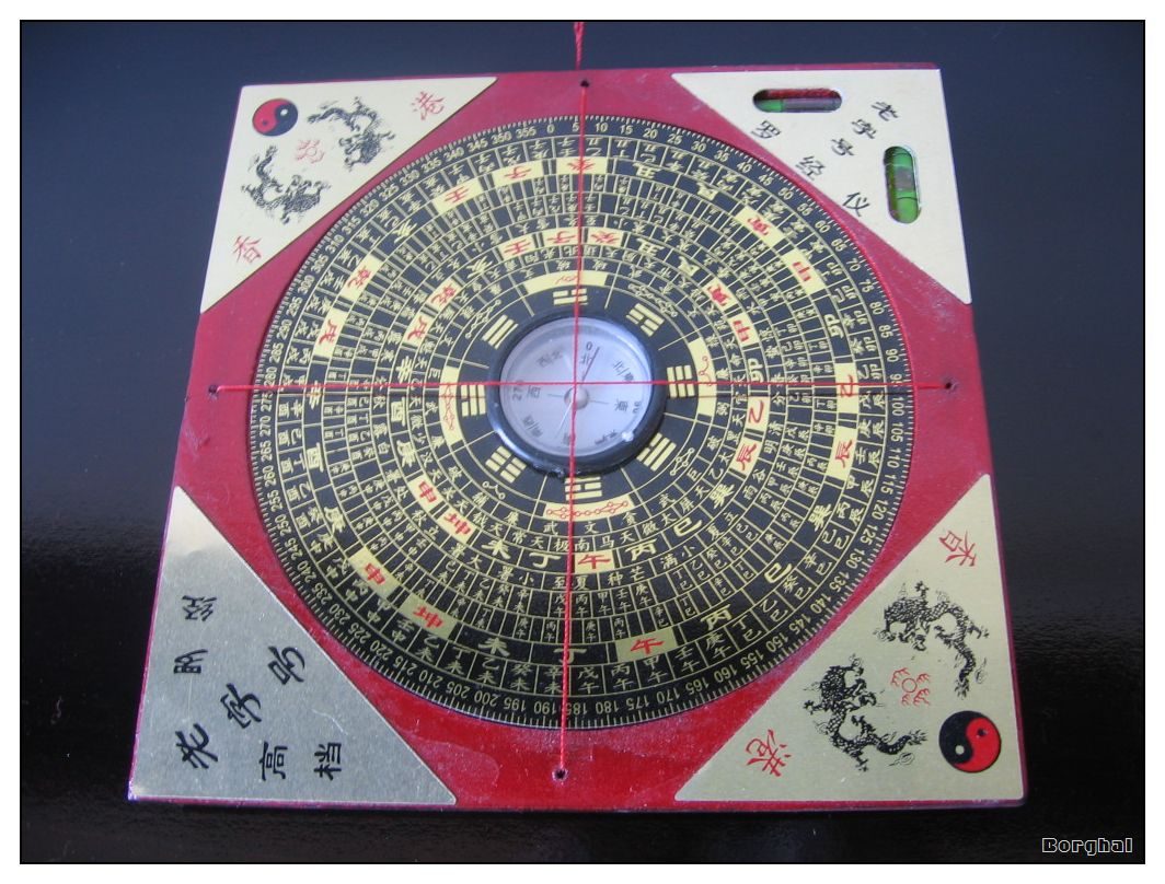
China formalized its own version and never stopped using it. Feng shui, literally 'wind and water,' is a system of siting buildings and tombs that goes back at least to the Han Dynasty, around 200 BCE. At its heart are the long mai, the 'dragon veins': channels of qi energy said to run through the land along mountain ridges and watercourses. The metaphor is not decoration, it is the framework. Mountain ranges are dragons, their ridgelines are the dragons' spines, and flowing water is the dragon's blood. You site a palace or a grave to catch the favorable flow.
And this was never fringe. Chinese cities, imperial tombs, and temples were laid out on feng shui principles, Beijing, Xi'an, and the Ming Tombs among the documented cases. It operated at the level of the state: imperial geomancers were court officials, named in the dynastic records. It is still in mainstream use today, with developers and municipalities in Hong Kong, Taiwan, and Singapore consulting feng shui masters on real buildings.
The science splits cleanly in two. Qi, as a universal energy, has no counterpart anywhere in modern physics; the dragon veins are unfalsifiable. But a surprising amount of feng shui is sound environmental design wearing a metaphysical coat. A building that faces south in the Northern Hemisphere really does get more sun. Water features really do moderate a microclimate. A mountain at your back really is a windbreak. Strip away the qi and you are left with a genuinely useful set of rules for living well in a landscape.
It is tempting to fold long mai and ley lines into one idea, invisible energy lines connecting the land, and at the level of metaphor they do rhyme. But the structure is different in a way that matters. Feng shui follows the natural shape of the world, the actual ridges and rivers that are already there. Watkins' leys are straight lines drawn between things people built. One reads the land; the other reads the map. The parallel is poetic, not structural.
11Songlines: The System That Works
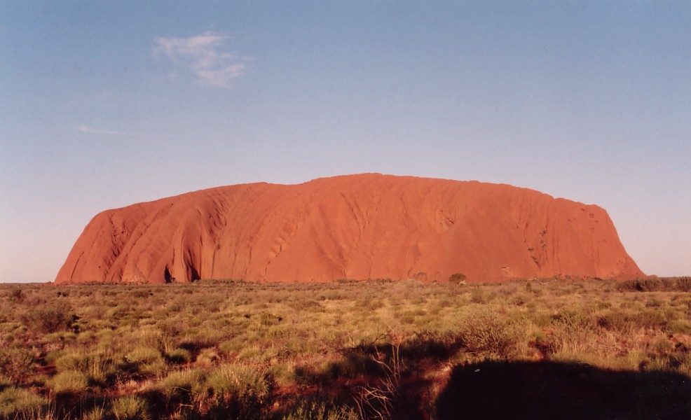
The most powerful answer to the whole ley-line question is not European at all, and it is not a relic. Across Australia, Aboriginal peoples maintain songlines, sung routes that thread across the continent, and they are a working technology of memory. A single songline can encode a path of thousands of kilometers: where the water is, when and where the food comes into season, where the dangers lie, how to steer by the stars, which sites are sacred and what Dreaming narratives belong to them, and the law and obligations that bind the people who travel it. The knowledge is carried in song, and the song is a map, a calendar, a legal code, and a history all at once.
And it is testable, which is the astonishing part. Recent research has found that some songlines accurately describe stretches of coastline that are now underwater, drowned watering holes and lost shorelines that match the real geology of a coast the rising seas swallowed more than ten thousand years ago. That is oral knowledge holding its shape across the end of the last ice age.
The astronomy is just as concrete. AIATSIS, the Australian Institute of Aboriginal and Torres Strait Islander Studies, has documented how songlines function as detailed star maps, guiding seasonal migration by the positions of the sky. This is celestial navigation, taught and remembered without a single written word.
So songlines are the closest thing on Earth to what the ley-line enthusiasts imagine: ancient pathways connecting sacred sites and carrying encoded knowledge, verified against both the ground and the sky. But the file insists on one distinction, and so will we, because it is the difference between honoring a living tradition and misusing it. Songlines are cultural knowledge systems. They are memory, law, astronomy, and navigation held in song. They are not 'earth energy,' and they must not be dissolved into the same mystical grid this file spends its length taking apart. They are something better than that story. They are true.
12The Global Grid, And One Honest Number
Zoom out from single cultures to the whole planet and the claims get grander and thinner. The best known is the Becker-Hagens grid, which maps ancient sites onto a global lattice built from Platonic-solid geometry, an icosahedron married to a dodecahedron and wrapped around the Earth. It is a beautiful figure. It is also statistically empty: at the density of major ancient sites worldwide, almost any geometric grid you draw will pass near a great many of them, and no one has shown the fit exceeds chance. Elegance is not evidence.
But there is a real study underneath the noise, and it deserves to be reported accurately, because it is more interesting than either the believers or the debunkers make it. In 2025, Michael Rosola of Rosola Laboratories put the popular 'sites on a single line' idea to an actual test. He took seventeen named ancient sites, Giza, Nazca, Easter Island, Machu Picchu, Ollantaytambo, Sukhothai, Tassili n'Ajjer and more, corrected their coordinates, and computed the single best-fit great circle through them all.
The fit was startlingly tight. The correlation came back with an R-squared of 0.9998, with the individual sites falling between roughly four and a hundred kilometers from the ideal line, Sukhothai closest at 4.37 km, Tassili n'Ajjer farthest at 101.85 km. On its face, that looks like a smoking gun.
It is not, and the person most insistent about that is Rosola himself. He flags the fatal weakness in his own method out loud: the site list was hand-picked, and famous alignments that would have broken the pattern, Stonehenge and Gobekli Tepe among them, were deliberately left off it. And he names the deeper mathematical trap plainly.
That is the whole subject in one honest sentence, from a researcher who found a spectacular correlation and refused to inflate it. And rather than reaching for a lost civilization, Rosola reaches for geology. He speculates that if such an alignment is real, it might be a fossil of crustal displacement, the whole crust of the planet slipping over cycles of ice ages, landmasses possibly rotating some thirty degrees, on the order of two thousand miles, so that sites built at different times end up on a line drawn by a moving Earth rather than by a moving people. It may well be wrong. But it is the kind of explanation neither the ancient-astronaut crowd nor the reflexive debunkers ever put on the table, and it is a reminder that the corrective to a bad answer is a better question, not a smug one.
Set against all that, the strong claims collapse. That the world's ancient sites align precisely on a single global line, or map cleanly onto a planetary grid, remains unconfirmed by any rigorous statistical test; at global site density, near-misses are guaranteed and prove nothing on their own. As a demonstrated fact, the precise-global-alignment grid is [DEBUNKED]. What actually survives is smaller, stranger, and more honest: one very tight correlation across a hand-picked list, openly flagged by the man who found it, pointing maybe at the movement of the crust and maybe at nothing.
13Telluric Currents And The Dowsing Rod
One more real phenomenon gets pressed into service by the energy theory, and it deserves the same clean split as the magnetism. Telluric currents are genuine: natural electric currents really do flow through the Earth's crust. But they go where the rock lets them, following paths of geological conductivity, and they have no interest whatsoever in running straight between one ancient monument and the next. The 'earth energy' story takes a real geophysical effect and drapes it over an imaginary geometry. The current is real. The ley it supposedly flows along is not.
And the tool people reach for to 'feel' these lines has been tested to exhaustion and failed every time. Dowsing, the claim that a rod or pendulum can detect hidden water or earth energy, has never once worked under controlled conditions. When J. T. Enright reviewed the results of more than two thousand dowsing trials, including the large and carefully run Munich experiments, in 1999, he found no accuracy beyond pure chance. Not weak evidence. No evidence. [DEBUNKED]
Fast Facts
- The Original Idea
- Alfred Watkins, 1921: ancient sites appear to line up, and he read the alignments as practical prehistoric trade routes, not energy. Published as The Old Straight Track in 1925.
- The Mystical Turn
- The 'earth energy' overlay was added by John Michell in 1969, forty-four years later and by a different author. Watkins never proposed it.
- The Statistics
- Britain has about 40,000 recorded sites. At that density, alignments of four or more points are expected by chance, and random simulations produce just as many as the real map.
- The Strongest Case
- The St. Michael's Line, roughly 350 miles from St. Michael's Mount to Hopton, whose repeated dedication of churches to St. Michael is harder to write off as coincidence.
- The Real Anomalies
- Granite is magnetic; the Rollright Stones show a measured anomaly at the circle's edge; a 2023 PNAS study read a geomagnetic surge out of inscribed Mesopotamian bricks, spiking under Nebuchadnezzar II.
- The Documented Network
- Cusco's 41 ceque lines radiate from the Coricancha to about 328 sacred huacas, recorded by Bernabe Cobo in 1653 and confirmed by modern fieldwork.
- The Living System
- Aboriginal songlines encode routes of thousands of kilometers and accurately describe coastlines drowned by the sea more than 10,000 years ago. Cultural knowledge, not earth energy.
- The Most Debunked
- Erich von Daniken's 1968 claim that the Nazca Lines were alien landing strips, which this research file names the single most debunked claim in the entire project.
So Is The Earth Wired Or Not?
The measurable core is solid, and there is more of it than skeptics expect. Earth's magnetic field really is anomalous, granite really is magnetic, the Rollright Stones really do sit on an anomaly, and inscribed Mesopotamian bricks really did record a geomagnetic surge under Nebuchadnezzar II. Carnac's three thousand stones, Nazca's fifteen hundred geoglyphs, and Cusco's ceque network are all physically, verifiably real. And Aboriginal songlines are a genuine navigation and knowledge system, tested against drowned coastlines and the night sky. All Tier 1. None of it in doubt.
One case earns a second look without earning a conclusion. The St. Michael's Line's recurring dedication to a single saint is a real pattern that raw geometry does not obviously explain, though the file's own counter, that dedications may follow an older route and that 'on the line' hides generous margins, keeps it short of proof. Nazca's functional theories sit here too, Reiche's calendar and especially Aveni's water-and-ritual ray centers: credible, partial, unfinished.
Several ideas are interesting and unproven, and stay that way. That ancient builders deliberately chose magnetically active ground. That Carnac's rows track the sky, as Thom argued. That qi flows in dragon veins. That any planetary grid is more than a coincidence of density. And the striking Rosola great-circle correlation, an R-squared of 0.9998 across a hand-picked list of sites, whose own author warns that enough points will fit almost any line, and who points, tantalizingly, at a moving crust rather than a lost civilization. Real questions, none of them settled.
And the load-bearing myths are refused outright. Ley lines do not prove a lost advanced civilization; the energy was invented in 1969, not remembered from antiquity. [DEBUNKED] The world's sites do not fall on a single precise global grid beyond what chance guarantees. [DEBUNKED] Dowsing does not detect anything; more than two thousand trials found nothing beyond chance. [DEBUNKED] And the Nazca Lines were not alien runways, the claim this file calls the most debunked in the entire project. [DEBUNKED] Four hard noes, and the article is cleaner for saying them.
So here is where the grid actually leaves us. The mystical version, an invisible energy pulsing through a planet-sized circuit, is not there; physics looked, and it is not there. But the impulse behind it turns out to be one of the most human things we have. In Australia they sang the land into a map. In China they read the dragons in the ridgelines. In the Andes they drew forty-one lines out from a single temple and kept time by them. Every one of those is real, and every one did what the ley-line believers only imagined: it wrote knowledge into the landscape and walked it. Watkins saw straight lines and thought of roads. Michell saw them and thought of power. Maybe the better question is the one all three living systems answer in their own way, and we keep forgetting to ask: not whether the Earth is wired, but why every people that ever crossed it reached for the same straight line, and what, exactly, each of them was really trying to remember?
Sources & further reading
Everything above is drawn from our research library on Theories of Anything, and every claim traces to the files below. The primary file is O_1_01, Ley Lines, Earth Energy Grid & Sacred Geography, which carries Watkins' original 1921 trackways and Michell's 1969 energy overlay, the random-alignment statistics and the St. Michael's Line, the measurable magnetic anomalies at Rollright and in the Mesopotamian bricks, the sacred-site geology, the physically real alignments at Carnac, Nazca, and Cusco, the feng shui and songline analogs, and the Tier 4 refusals this dossier ends on. Companion files go deeper on the worldwide pyramid-alignment claims, on Chinese dragon geography, on megalithic engineering, and on sacred geometry. A sibling dossier in this same wing, on why ancient sites so often sit on magnetic weirdness, will carry the instrumented-measurement depth when it is built. Open the full files to check the sourcing and go deeper.
Image credits
- The Menec alignments at Carnac, Brittany photograph by Snjeschok, via Wikimedia Commons. Dual-licensed GNU Free Documentation License v1.2 or later and Creative Commons Attribution-ShareAlike 3.0 Unported Source.
- The Nazca monkey geoglyph, Nazca Pampa, Peru photograph by Unukorno, via Wikimedia Commons. Creative Commons Attribution 3.0 Unported Source.
- A traditional Chinese feng shui compass (luopan) photograph by Christian Orellana (Commons user borghal), via Wikimedia Commons. Creative Commons Attribution 2.0 Generic Source.
- The Coricancha (Temple of the Sun), Cusco, Peru photograph by Håkan Svensson (Commons user Xauxa), via Wikimedia Commons. Dual-licensed GNU Free Documentation License v1.2 or later and Creative Commons Attribution-ShareAlike 3.0 Unported Source.
- The World Digital Magnetic Anomaly Map compiled by the World Digital Magnetic Anomaly Map project (WDMAM), via Wikimedia Commons. Creative Commons Attribution 4.0 International Source.
- St. Michael's Mount, Cornwall, England photograph by Commons user Nina, via Wikimedia Commons. Creative Commons Attribution-ShareAlike 3.0 Unported (also offered under 2.5, 2.0, and 1.0 Generic) Source.
- Uluru (Ayers Rock), Northern Territory, Australia photograph by Stefanoka, via Wikimedia Commons. Creative Commons Attribution-ShareAlike 3.0 Unported Source.
- The King's Men stone circle, Rollright Stones, Oxfordshire photograph by Sarah Charlesworth, via Wikimedia Commons. Creative Commons Attribution-ShareAlike 2.0 Generic Source.
- Card crop of The Menec alignments at Carnac, Brittany photograph by Snjeschok, via Wikimedia Commons. Dual-licensed GNU Free Documentation License v1.2 or later and Creative Commons Attribution-ShareAlike 3.0 Unported Source.


