The Missoula Floods: How a Heretic Was Proven Right
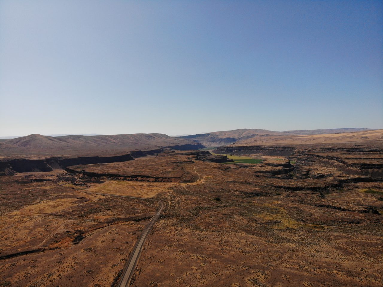
Look at a map of eastern Washington and you will find a landscape that should not exist: a plateau of solid basalt gouged into dry canyons hundreds of feet deep, a waterfall five and a half kilometers wide with no river above it, gravel ripples the size of houses, boulders the size of buildings stranded on hilltops. In 1923 a Chicago geologist named J Harlen Bretz said the only thing that could carve all of it was a flood of almost unimaginable violence. For that, the geological establishment spent the better part of forty years treating him as a crank. He was right. Every scarred coulee, every abandoned cataract, every giant ripple is the fingerprint of a real megaflood, one of the largest freshwater floods known in Earth's history, that swept the Pacific Northwest again and again at the end of the last Ice Age. This is the story of the evidence, and of the man who read it before anyone else would. Here is the file, every fact wearing its tier.
There are two stories tangled together here, and the honest way to tell them is to keep them apart. One is a story about rock, water, and numbers so large they stop meaning anything, and almost all of it is settled beyond argument. The other is a story about a person, a scientific establishment, and how long it can take a true idea to be believed, and that one is where the color lives, and where we have to be careful about what we actually know. So we will read them both, tier by tier, because the fastest way to cheapen a genuinely great vindication is to embellish it. Let us open the file.
01The Man Who Saw A Flood
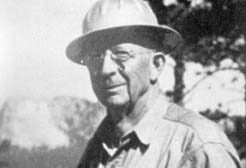
Start with the heretic himself. He was born Harley Bretz on September 2, 1882, in the farming town of Saranac, Michigan, and he built the rest of his name by hand. As an adult he invented the 'Harlen' and put the initial 'J' in front of it, and, as his daughter later told a biographer, made the whole thing up because he did not think plain Harley sounded professional enough. His University of Chicago advisor, Rollin D. Salisbury, told him never to write a period after that lone 'J,' because it was not an abbreviation of anything, it was his whole first name. Bretz took his PhD in geology at Chicago in 1913, trained by Salisbury and by Thomas Chrowder Chamberlin, the man who formalized the method of multiple working hypotheses, the very discipline of testing an idea against all its rivals that Bretz's own career would come to be a parable about.
In 1922 Bretz moved his advanced Chicago summer field course out to the Columbia Plateau of eastern Washington, helped by a Spokane schoolteacher named Thomas Large. Across the 1922 and 1923 seasons he and his students mapped an assemblage of landforms that made no sense under the gentle, gradual geology of the day: immense dry cataracts, deep coulees, rock basins, braided channels cut straight into naked basalt. Bretz drew the only conclusion the evidence allowed. In 1923 he published 'The Channeled Scablands of the Columbia Plateau' in the Journal of Geology and argued that a colossal flood had done it. His own words: 'It was a debacle which swept the Columbia Plateau.' He first named the event the Spokane Flood, and he coined the term that stuck to the land itself, the Channeled Scablands.
02The Scars On The Land
The Channeled Scablands are the exhibit, and they are enormous. They sprawl across something like 15,000 to 40,000 square kilometers of the Columbia Plateau in eastern Washington, and everywhere the flood passed it stripped the land to the bone. It tore the wind-blown soil off the underlying basalt, gouged deep dry canyons called coulees, and left waterfalls with nothing flowing over them. Grand Coulee alone runs 80 kilometers long, up to 10 kilometers wide, and as much as 300 meters deep, cut clean through solid lava rock. Moses Coulee is another channel of the same kind. Between them stand streamlined hills of surviving soil, loess islands shaped like teardrops by the water that flowed around them, and hanging valleys whose floors were left stranded tens of meters above the scoured main channel.
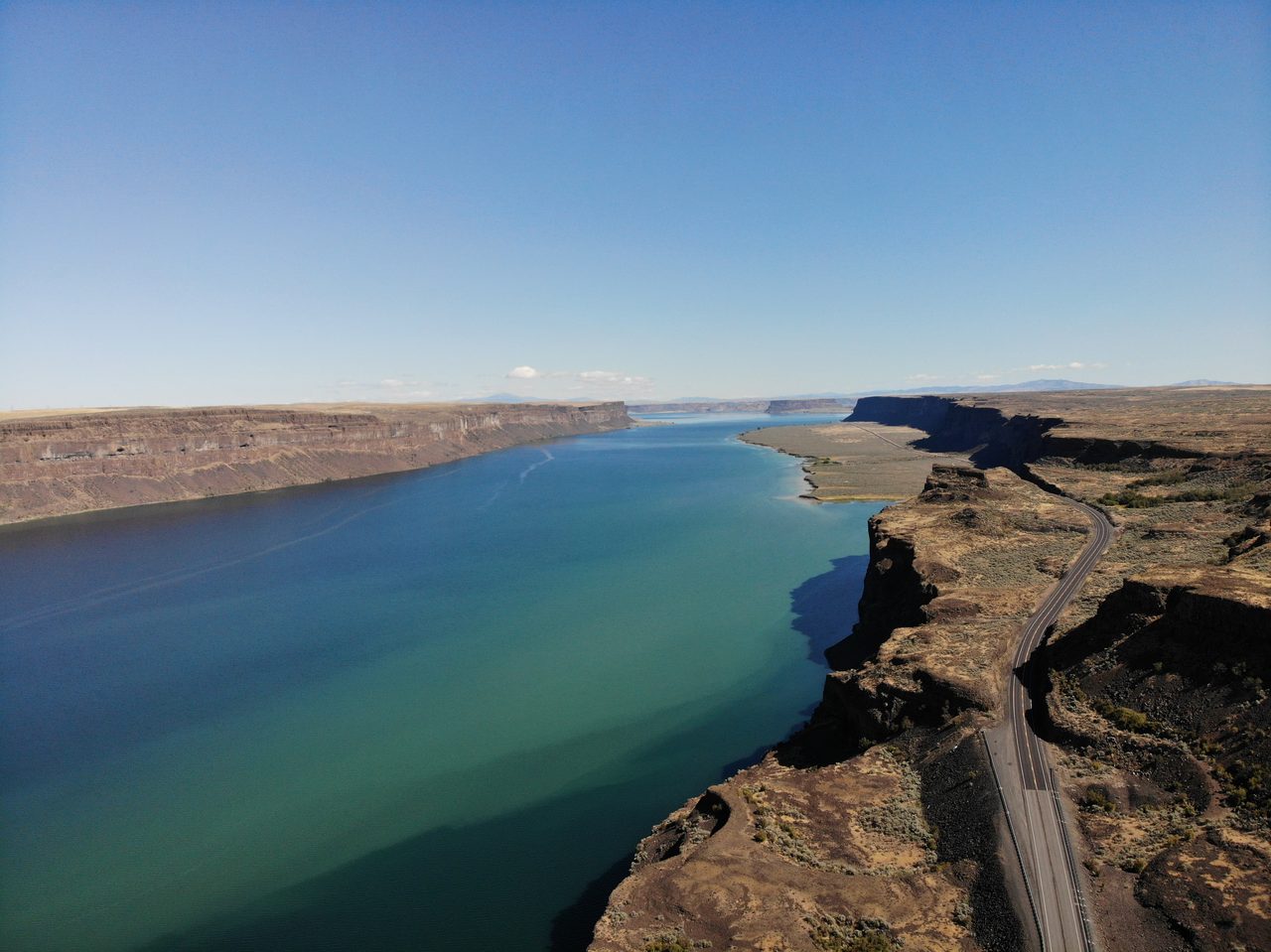
The single most staggering piece of evidence is a waterfall where no water falls. Dry Falls, in central Washington, is a horseshoe cliff 120 meters high and 5.5 kilometers wide, roughly 400 feet tall and three and a half miles across, a dead cataract on a scale no living waterfall on Earth can match. Stand at its lip and you are looking at the place where a flood, not a river, once poured over the edge. It has been bone dry for thousands of years.
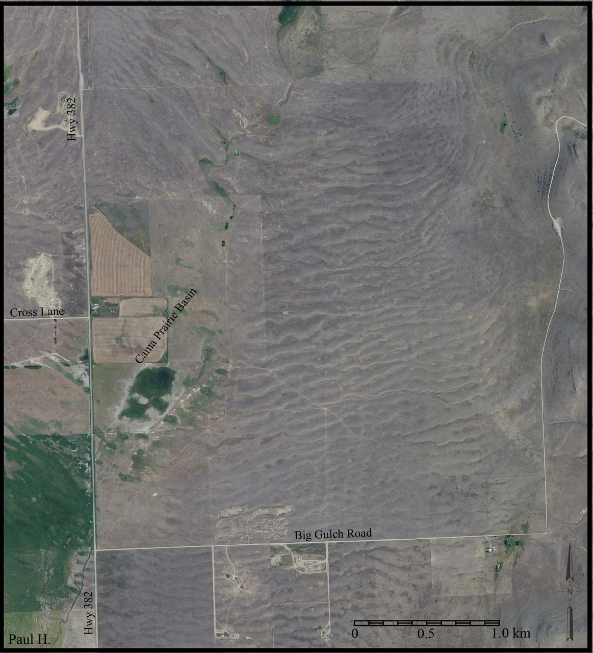
Then there are the ripples. Ordinary streams leave little ripples in sand, a few centimeters high. The Missoula floods left the same shapes scaled up into gravel dunes up to 15 meters high and 150 meters from crest to crest, so large that for years geologists walked across them without realizing what they were standing on. The finest field of them, at Camas Prairie, Montana, is visible from the air and counted among the largest current ripples known on Earth, built by dozens of emptyings of the lake over thousands of years. You cannot make ripples like that with a river. You need a flood tens of meters deep moving at highway speed.
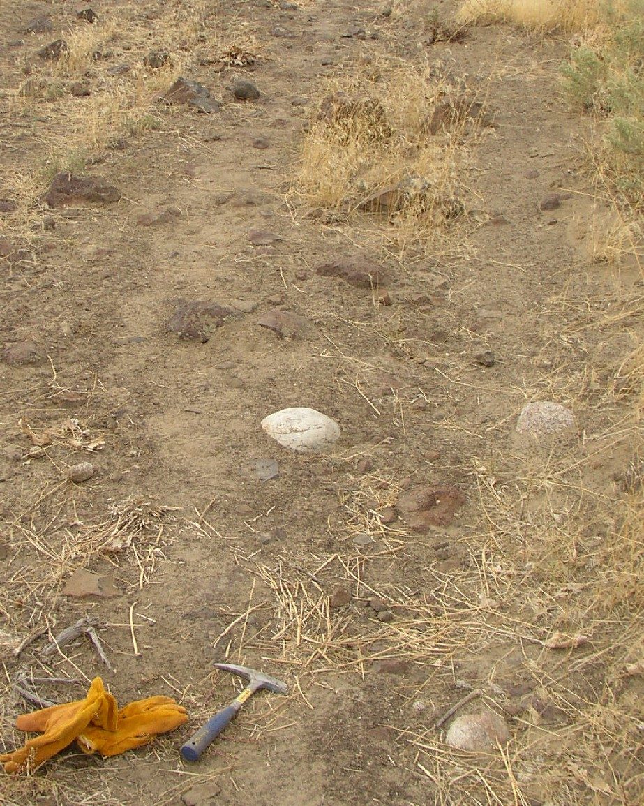
Two more kinds of evidence seal it. Boulders more than 10 meters across were rafted tens to hundreds of kilometers from their bedrock and dumped on high ground, glacial erratics stranded like flotsam. A cluster of them still sits on Red Mountain in the mid-Columbia, an isolated hill that stood up as an island while the flood filled the basin around it to some 1,200 feet above sea level. And where the water backed up into quiet side valleys, it dropped its fine sediment in neat rhythmic layers, one graded bed per flood pulse. At Burlingame Canyon, Oregon, geologists have counted more than 40 of those layers stacked on top of each other. That last detail matters more than any other, and we will come back to it, because a stack of 40 flood beds is very hard to explain with a single flood.
| Feature | What You See | What It Means |
|---|---|---|
| The Channeled Scablands | 15,000 to 40,000 sq km of basalt stripped bare | Sheet flooding scoured the soil off the bedrock |
| Grand Coulee | An 80 km long dry canyon, up to 300 m deep | A flood cut a canyon through solid lava |
| Dry Falls | A dead cliff 120 m high and 5.5 km wide | A cataract larger than any living waterfall |
| Giant current ripples | Gravel dunes up to 15 m high, best seen from the air | Ordinary ripples scaled to a flood tens of meters deep |
| Glacial erratics | Boulders over 10 m across stranded on hilltops | Rock rafted far from its source and left behind |
| Slackwater rhythmites | 40-plus flood beds stacked in quiet side valleys | A separate layer for each of many floods |
03The Lake Behind The Flood
So where did all that water come from? This was the question Bretz could not answer, and it nearly sank him. The answer sat hundreds of kilometers to the east, in the mountain valleys of western Montana. During the late Pleistocene, roughly 18,000 to 15,000 years ago, a lobe of the Cordilleran Ice Sheet pushed south down the Purcell Trench into the Clark Fork River valley of what is now northern Idaho, at the site of modern Lake Pend Oreille. That tongue of ice acted as a dam, and behind it a vast lake filled up: Glacial Lake Missoula.
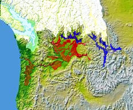
At its fullest, Glacial Lake Missoula was a freshwater sea. It stood about 300 meters deep against the ice dam, backed up some 300 kilometers into the Montana valleys, and held roughly 2,500 cubic kilometers of water. That is difficult to picture, so try this: it held about as much water as Lakes Erie and Ontario put together, or about half of Lake Michigan, impounded behind a wall of ice.
You can still see the lake's bathtub rings. On the mountainsides above Missoula, Montana, more than 30 old shorelines are cut into the slopes of Mount Sentinel and Mount Jumbo, each one a level the lake once stood at, one after another. Hiking trails switchback straight through them today. Thirty-odd shorelines are not the record of one lake that filled once and drained once. They are the record of a lake that filled and emptied over and over.
That is exactly what happened. The ice dam formed, the lake filled, the dam failed catastrophically, the lake emptied in a matter of days, and then the glacier advanced again and the whole thing began over. The cycle repeated something like 40 to 80 or more times across roughly 2,000 to 3,000 years. Each collapse sent a wall of water racing across the plateau toward the Pacific. The Scablands are not the scar of a single disaster. They are the scar of dozens.
04The Numbers That Stop Meaning Anything
When the dam gave way, the numbers left arithmetic behind. Peak discharge for the largest floods is estimated at 10 to 17 million cubic meters per second. That is the greatest freshwater discharge known anywhere in Earth's history, and it is roughly ten times the combined flow of every river on the planet today, pouring out of one broken ice dam.
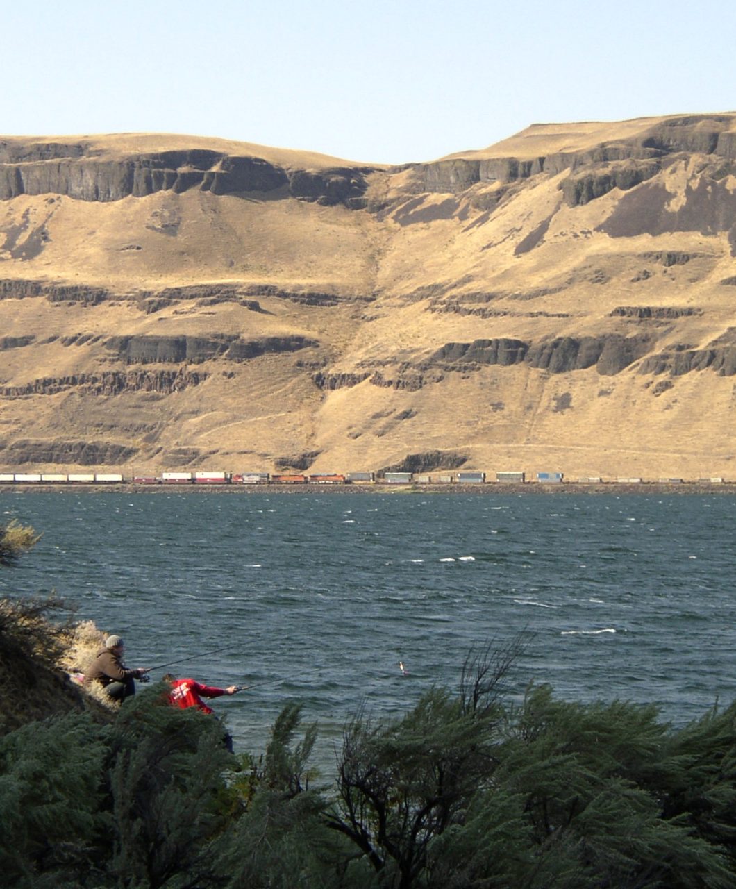
The water moved at 20 to 30 meters per second in the narrows, 45 to 67 miles an hour, a wall of water traveling at freeway speed. In the main channelways it ran 100 to 250 meters deep. Where it hit the constriction at Wallula Gap on the Columbia River, more water arrived than the gap could pass, so it ponded, backing up until the surface stood roughly 370 meters above sea level. Picture a temporary lake hundreds of feet deep forming in hours, simply because the land could not drain fast enough.
| Measure | The Figure | For Scale |
|---|---|---|
| Lake volume | ~2,500 cubic km | Lakes Erie and Ontario combined |
| Peak discharge | 10 to 17 million cubic meters per second | ~10x every river on Earth today |
| Flow speed | 20 to 30 m/s (45 to 67 mph) | Freeway speed, through the narrows |
| Flow depth | 100 to 250 m in the channels | Up to ~370 m ponded at Wallula Gap |
| Number of floods | Dozens, at least about 40 | The exact count is still debated |
05The Heresy Trial
Now the human story turns hard. In January 1927 Bretz was invited to present his flood evidence to the Geological Society of Washington. What he walked into was an ambush. One after another, the established geologists of the day rejected his idea out of hand, not because they had a better explanation for the Scablands, but because catastrophe itself was forbidden. Their science was built on the principle that the present is the key to the past, that landscapes are made slowly, by the same gentle processes we can watch working today. A continent-scale flood was, to them, an offense against the whole framework. Tellingly, per the record, not one of them offered any alternative account of how the Scablands actually formed. They only objected.
Popular accounts of that meeting, drawn from later retellings rather than a transcript, describe it in bruising terms. Contemporaries reportedly called it a lynching, and later writers a beatdown. Critics are said to have branded the flood theory wholly inadequate, preposterous, and incompetent, and Bretz himself is remembered describing the panel as six challenging elders. Treat those exact words with a light hand: they come from popular biographical sources, not from the peer-reviewed record of the meeting, and the specific quotes do not appear in the rigorous modern retrospective of Bretz's career. What is not in doubt is the shape of the thing. A single geologist, with the field lined up against him.
His most stubborn opponent had a name. Richard Foster Flint, a Yale geologist and one of the most influential figures in the field, is remembered across the accounts as Bretz's most persistent adversary, resisting the flood hypothesis for decades. By one telling he did not concede the point until 1971, and then only in a single grudging sentence buried in a textbook. This too is popular-source narrative rather than peer-reviewed record, so hold the specifics loosely, but the long institutional resistance it describes is real, and it is why this story takes forty years to resolve.
06The Man Who Held The Missing Key
Bretz's critics did have one fair point. He could describe the flood, but he could not say where the water came from, and a flood needs a source. The source had, in fact, already been found, by a quieter man. Joseph Thomas Pardee, a geologist with the US Geological Survey, had documented Glacial Lake Missoula and even the giant ripple marks on the bed of the vanished lake itself. His formal paper, 'Unusual Currents in Glacial Lake Missoula, Montana,' appeared in the Geological Society of America Bulletin in 1942. Here was the missing reservoir: an ice-dammed lake holding thousands of cubic kilometers of water, poised to empty in an instant. Lake plus broken dam equals Bretz's flood.
There is a poignant detail here that the popular accounts preserve and the dry record does not. Pardee is said to have seen the connection between his lake and Bretz's flood long before he published it, and to have kept quiet for years, because his own superiors at the Survey were among Bretz's fiercest critics, and openly tying the agency's findings to a heretical theory could have cost him his career. Bretz later reportedly credited that restraint, saying Pardee generously left the connection to him. It sits at the softer, popular-sourced end of the evidence, but if it is true, it means the single most important piece of corroboration in the whole affair sat available yet unspoken for years, held back not by science but by the fear of what an institution does to the person who says the forbidden thing out loud.
07All His Enemies Are Dead
The turn came in the field, not the lecture hall. In 1965 the International Association for Quaternary Research ran a field conference through the Scablands, walking geologists across the actual coulees, cataracts, and gravel bars. You can argue with a slideshow. It is much harder to argue with a 120-meter dry waterfall you are standing beside. The participants were, by and large, convinced by what they saw.
The most repeated line from that conference is that the geologists in the field sent Bretz, by then in his eighties, a telegram reading: 'We are all now catastrophists!' The exact wording comes from popular retellings rather than the peer-reviewed record, so quote it as the legend it has become. The fact underneath it is solid, and the corpus record confirms the substance: the people who had spent careers doubting him came back from the Scablands believing.
Vindication arrived in full in 1979, when the Geological Society of America awarded Bretz the Penrose Medal, its highest honor. He was 96 or 97 years old at the time, the accounts disagree by a year. It was the establishment that had ridiculed him, now handing him its greatest prize for the very idea it had rejected. His own summary of what he had done, quoted in the peer-reviewed record, was characteristically plain: 'Perhaps I can be credited with reviving and demystifying legendary catastrophism and challenging a too rigorous uniformitarianism.'
There is a last line often attached to him around that time, that he joked all his enemies were dead, so he had no one left to gloat over. It is repeated widely and it is very much in character, but it does not appear in the peer-reviewed retrospective, so enjoy it as a good story rather than a documented quote. He had, in any case, outlived the argument.
Bretz did not spend the intervening decades waiting to be believed. Having published more than a dozen major papers on the Scablands between 1923 and 1932, he largely walked away from the fight in the mid-1930s and went to work on other things: glacial fieldwork in East Greenland on the 1933 Boyd expedition, and then, from 1938 to 1961, a sweeping study of limestone caverns across seventeen US states, Mexico, and Bermuda that helped put cave science on a serious footing. He died on February 3, 1981, in Homewood, Illinois, at the age of 98, two years after the medal, having lived long enough to be completely, publicly right.
08So, Was He Right?
Here is where an honest telling earns its keep, because the tidy version of this story, lone genius against a blind establishment, is not quite the whole truth. Bretz was right about the thing that mattered most, and wrong about a real detail, and both halves deserve saying.
Bretz's original 1923 hypothesis was that the Scablands were carved by a single catastrophic flood. That specific version is now superseded. The modern consensus, built from the stacked rhythmites, the thirty-plus lake shorelines, and radiometric dating, is that there was not one flood but dozens, each individually catastrophic, recurring across two to three thousand years. This is worth stating carefully, because it is a refinement of Bretz's idea, not a refutation of it. His core claim, that immense floods and not slow erosion made this landscape, was completely vindicated. What changed is the count. He said one. The rock says many. Ironically, some of the evidence that now proves the many-floods picture, those 40 stacked flood beds at Burlingame Canyon, is exactly the kind of thing a single-flood model could never have produced.
And the count is still not settled. Estimates for the number of distinct Missoula floods range from about 25 to more than 80. Rhythmite counts point to at least 40, but some floods may have been too small to leave a clear layer, and later floods erased the deposits of earlier ones, so the true number is genuinely uncertain. The average time between floods is put at roughly 35 to 55 years, though individual gaps varied. This is not settled science dressed up as debate. It is a real, active question, and the honest answer to how many floods there were is that we do not yet know exactly.
09What The Flood Still Touches
Who was standing there when it happened? There is limited but real evidence that Clovis or pre-Clovis people were in the Pacific Northwest during the final flood cycles. The floods rebuilt the region even as they destroyed it, laying down the fertile bottomlands of the Willamette Valley and the Portland basin while scouring the uplands bare. No archaeological trace of a person killed by the floods has been found, but anyone living along the Columbia corridor during those millennia faced a hazard that returned, without warning, every few decades.
Whether any memory of that hazard survived is a genuine open question, and a speculative one. Some scholars, going back to a 1953 study by Clark, have noted flood stories among the Kalispel, Spokane, and other Plateau peoples and wondered aloud whether they preserve an echo of the Missoula floods. It is an evocative idea. It is also, honestly, unprovable: linking a living oral tradition to events roughly 15,000 years old, across something like 600 generations of retelling, is beyond what the evidence can carry. Mark it speculative and leave it there.
The floods also changed how we read another planet. From the 1970s on, Vic Baker and others used the Channeled Scablands as the terrestrial key to the great outflow channels of Mars, features like Ares Vallis and Kasei Valles that look, at planetary scale, remarkably like Bretz's coulees. The reading is that catastrophic megafloods carved those Martian channels too, on an early Mars that once had liquid water in violent motion. Bretz's flood, once too catastrophic to be allowed on Earth, became a model for understanding floods on Mars, and helped rehabilitate catastrophism as a respectable idea across the earth sciences.
There is even a possible fingerprint on the climate of the whole Northern Hemisphere, though here the ground gets soft. Researchers have asked whether the final Missoula floods fed Meltwater Pulse 1A, a rapid sea-level rise about 14,600 years ago, or nudged the North Atlantic's ocean circulation. The straightforward version of that idea is unlikely on its face, because the Missoula floodwaters drained into the Pacific, not the Atlantic.
But a 2020 modeling study by Praetorius, Condron, and colleagues, in Science Advances, proposed a subtler route. Their simulations traced Missoula meltwater out into the North Pacific, along the Kuroshio Current toward Japan, and, once the Bering Strait opened, on through the Arctic and into the North Atlantic, where it could have influenced the abrupt climate swings of the last deglaciation. It is a single study proposing a specific, indirect mechanism, not a settled result, but it is a real and current one, which means an Ice Age flood that finished 15,000 years ago may still be shaping how scientists model abrupt climate change today.
10What This Is Not
Because this is a site that takes real catastrophes seriously, it has to be just as clear about the false one that always gets attached to them.
No, the Missoula floods are not proof of Noah's Flood, and reading them that way gets the science exactly backwards. The floods were genuinely, spectacularly catastrophic, but they were regional, confined to the Pacific Northwest, not global. They were many separate events, not one. And they unfolded over thousands of years at the end of the last Ice Age, driven by a failing ice dam, not by a single worldwide deluge. Everything that makes them scientifically real, the ice-dammed lake, the repeated dam failures, the local drainage into the Pacific, is exactly what makes them the opposite of a global flood. Wrong scale, wrong mechanism, wrong number. A real megaflood is not evidence for a mythical one.
11Every Claim, Every Tier
Here is the whole file on one page, each claim wearing its tier, because the surest way to ruin a true story like this one is to let the rock-solid geology, the well-documented career, the vivid secondhand anecdotes, and the flat falsehoods all blur into one undifferentiated legend. They are not the same, and the tiers are what keep them apart.
| The Claim | Tier | The Basis |
|---|---|---|
| Catastrophic megafloods carved the Channeled Scablands | Tier 1 | Bretz 1923; the physical evidence itself |
| Glacial Lake Missoula held ~2,500 cubic km behind an ice dam | Tier 1 | Strandlines, lake beds, corpus geology |
| Peak discharge reached 10 to 17 million cubic meters per second | Tier 1 | ~10x every river on Earth today |
| The floods recurred dozens of times over 2,000 to 3,000 years | Tier 1 | Rhythmites, 30-plus shorelines, dating |
| Bretz proposed the flood in 1923 and was rejected in 1927 | Tier 1 | Journal of Geology; the 1927 meeting |
| Pardee's ice-dammed lake supplied the missing water source | Tier 1 | Pardee 1942, GSA Bulletin |
| Bretz won the Penrose Medal in 1979 | Tier 1 | The GSA's highest honor |
| The 1927 meeting was a 'lynching,' the theory 'preposterous' | Tier 2 | Popular retellings, not a transcript |
| Richard Foster Flint was his most persistent opponent | Tier 2 | Popular secondary sources |
| Pardee stayed silent for years to protect his career | Tier 2 | Popular secondary sources |
| The 'We are all now catastrophists!' telegram, 1965 | Tier 2 | Popular retelling of a real conference |
| The exact number of floods, about 25 to 80-plus | Tier 2 | Genuinely still debated |
| The floods are a model for the outflow channels of Mars | Tier 2 | Baker 1978, Science |
| Missoula meltwater may have influenced abrupt climate change | Tier 2 | Praetorius et al. 2020, one study |
| Plateau flood myths preserve a memory of the floods | Tier 3 | Unprovable across ~600 generations |
| The floods directly drove Atlantic circulation change | Tier 3 | The water drained to the Pacific, not the Atlantic |
| Bretz's original single-flood version of the theory | Tier 4 | Superseded; there were dozens, not one |
| The Missoula floods prove Noah's Flood | Tier 4 | Rejected; regional, repeated, wrong mechanism |
Fast Facts
- The Landscape
- The Channeled Scablands, ~15,000 to 40,000 sq km of scoured basalt in eastern Washington
- The Source
- Glacial Lake Missoula, ~2,500 cubic km held behind a lobe of the Cordilleran Ice Sheet
- The Flood
- Peak discharge 10 to 17 million cubic meters per second, ~10x all the rivers on Earth
- How Often
- Dozens of separate floods over roughly 2,000 to 3,000 years, about 18,000 to 15,000 years ago
- The Heretic
- J Harlen Bretz, who proposed the flood in 1923 and was ridiculed for decades
- The Missing Key
- Joseph Thomas Pardee's ice-dammed lake, the water source Bretz's critics demanded
- The Vindication
- The 1979 Penrose Medal, geology's highest honor, from the establishment that mocked him
- The Refinement
- He said one flood; the evidence says dozens. Right about the cause, wrong about the count
- What It Is Not
- Not Noah's Flood: regional, repeated, ice-driven, and drained to the Pacific
- The Verdict
- The geology is certain; the exact flood count is open; the global-flood reading is false
What We Can Actually Stand Behind
The megafloods are beyond dispute. Catastrophic floods carved the Channeled Scablands, and Glacial Lake Missoula, some 2,500 cubic kilometers held behind an ice dam, was their source, recorded in more than 30 mountainside shorelines and in the stacked flood beds downstream. Peak discharge reached 10 to 17 million cubic meters per second, roughly ten times the flow of every river on Earth combined. Dry Falls, Grand Coulee, the giant ripples at Camas Prairie, and the stranded erratics are all real, and all the work of water. And the human timeline is documented: Bretz published the flood in 1923, was rejected in 1927, was handed the missing water source by Pardee's 1942 work on Glacial Lake Missoula, was believed after the 1965 field conference, and received the Penrose Medal in 1979. All Tier 1.
The color and the specifics sit a rung down. The vivid retellings of the 1927 meeting as a lynching, the naming of Richard Foster Flint as chief antagonist, Pardee's career-driven silence, and the 1965 'We are all now catastrophists' telegram come from popular biographical accounts rather than the peer-reviewed record, and should be read as well-attested story, not primary fact. The exact number of floods, somewhere between about 25 and more than 80, is genuinely still researched. So are the flood's role as a model for the outflow channels of Mars and its possible, indirect influence on abrupt climate change.
Some links stay guesses. Whether Plateau peoples' flood myths preserve a memory of the real event is unprovable across roughly 600 generations of oral transmission. And a direct influence of Missoula meltwater on North Atlantic circulation is unlikely on its face, since the water drained into the Pacific, whatever the more elaborate indirect pathways may yet turn out to show.
And two readings are simply wrong, so say it flatly. No, Bretz's original single-flood version of the theory does not survive; the evidence shows dozens of separate floods, which refines his idea rather than overturning it. And no, the Missoula floods are not proof of Noah's Flood. They were a regional, repeated, ice-driven catastrophe that drained to the Pacific over thousands of years, the opposite of a single global deluge in scale, mechanism, and number.
So hold the layers apart and the story stays honest, and somehow more impressive for it. A man read a violent history in a quiet landscape, was called a crank for forty years, and turned out to be right, right enough that his ridiculed flood is now how we read the surface of another planet. What the establishment could not forgive was not really that Bretz might be wrong. It was that he was willing to let a catastrophe back into a science that had outlawed them. That leaves the real question sitting where it started, out on the scablands, under a waterfall with no river: how many other landscapes are we still reading too gently, waiting for someone stubborn enough to see the flood?
Sources & further reading
Everything above is drawn from our research library on Theories of Anything, deep-read in full rather than skimmed. The corpus files are where we worked from; the papers, reports and primary records listed beneath them are where you can check us independently.
Image credits
- Dry Falls, Washington State photograph via Wikimedia Commons. CC BY-SA 4.0 Source.
- J Harlen Bretz, 1949 photograph via Wikimedia Commons. Public Domain Source.
- Grand Coulee and Steamboat Rock photograph via Wikimedia Commons. CC BY-SA 4.0 Source.
- Giant Current Ripples, Camas Prairie, Montana aerial photograph via Wikimedia Commons. CC BY 4.0 Source.
- Glacial Erratic Boulders, Red Mountain photograph via Wikimedia Commons. CC BY-SA 3.0 / GFDL Source.
- Map of Glacial Lake Missoula and the Flood Extent map via Wikimedia Commons, NASA. CC BY-SA 3.0 / GFDL Source.
- Wallula Gap, Columbia River photograph via Wikimedia Commons. CC BY-SA 3.0 / GFDL Source.
- Card crop of Dry Falls, Washington State photograph via Wikimedia Commons. CC BY-SA 4.0 Source.


