The Drowned Coastlines: What Is Actually Under the Water
Since the last ice age the sea has risen about 120 metres and swallowed roughly 25 million square kilometres of land, an area larger than North America. Real cities are down there and have been mapped. So are formations that look built and are not. Here is the file, every claim wearing its tier.
There is a version of this subject that sells books, and there is a version that survives contact with the evidence. They are not the same, and the strange thing is that the second one is bigger. The sales pitch is that a lost civilisation lies under the waves waiting to rewrite history. The evidence says something less cinematic and much harder to absorb: for most of the time our species has existed, the coastline was somewhere else entirely, and everything people built on it is now underwater. Not one lost city. Every coast on Earth.
That is a Tier 1 statement, and it does most of the work in this file. Once you have it, the interesting question stops being is anything down there and becomes which of the things down there were actually built by people. Some were. Some were not, and the ones that were not are often the famous ones. Let's open the file.
01The Hundred And Twenty Metre Fact
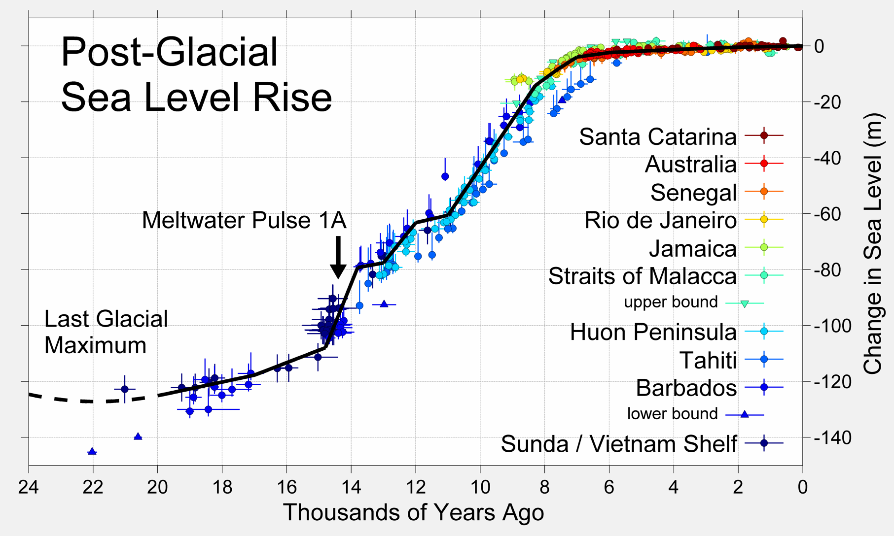
At the Last Glacial Maximum, roughly 26,500 to 19,000 years ago, enough of the world's water was locked into ice sheets that global sea level sat about 120 to 130 metres below where it sits today. As the ice melted, the water came back. By roughly 6,000 to 4,000 years ago the sea had reached approximately modern levels. The land that was drowned in between amounts to an estimated 25 million square kilometres, an area larger than North America. This is not a fringe reconstruction. It comes from sea-level and ice-volume work published in PNAS and Geophysical Research Letters, and it is the baseline every serious underwater archaeologist works from.
The rise was not a slow, even creep. It came in pulses. Meltwater Pulse 1A, around 14,600 years ago, raised sea level by something like 16 to 25 metres in roughly five centuries. Meltwater Pulse 1B, around 11,300 years ago, added perhaps 7 to 10 metres, with the timing still debated and broadly coinciding with the end of the Younger Dryas. Between the pulses there were pauses. The distinction matters more than it sounds. A rise of 25 metres in 500 years works out near 5 centimetres a year, which is fast enough that a person could watch a shoreline retreat across their own lifetime, and fast enough that a village site could become untenable within a few generations.
| Landmass | Where | Area lost | Depth now | Drowned |
|---|---|---|---|---|
| Sahul Shelf | North Australia | ~2,500,000 km² | 50 to 130 m | ~12,000 to 8,000 BCE |
| Sundaland | Southeast Asia | ~1,800,000 km² | 30 to 120 m | ~14,000 to 8,000 BCE |
| Beringia | Bering Strait | ~1,600,000 km² | 30 to 50 m | ~11,000 BCE |
| Doggerland | North Sea | ~23,000 km² | 20 to 50 m | ~6200 BCE |
| Persian Gulf basin | Arabian Gulf | ~800 km long | 30 to 100 m | ~8,000 to 6,000 BCE |
Read that table slowly, because the scale is the argument. Sundaland alone was larger than the Southeast Asia that is currently above water. Beringia is not a hypothetical: it is the verified migration route into the Americas, confirmed by genetics, and it is now under 30 to 50 metres of sea. The Sahul Shelf carried Aboriginal settlement sites that are now offshore.
None of these are lost continents in the mystical sense. They are ordinary land, with rivers and forests and people on it, that the sea took. The reason they feel exotic is simply that we have no habit of picturing the map any other way than the one on the wall.
02The Cities That Really Are Down There
Start with what has been surveyed, planned and published, because it sets the standard everything else has to meet.
Pavlopetri, off Laconia in southern Greece, lies in three to four metres of water and is the oldest known submerged town plan in the world. Nicholas Flemming identified it in 1967; a University of Nottingham team surveyed it systematically between 2009 and 2014. What is on the sea bed is not a suggestive jumble but a city plan: streets, courtyards, at least fifteen buildings, two rock-cut chamber tombs, across an area around 100,000 square metres. The main occupation is Early Bronze Age, roughly 3000 BCE, about 5,000 years ago, and some ceramics push habitation back toward the Neolithic near 3500 BCE, implying something like two millennia of continuous use. There is no sign of violent destruction. It went under through seismic subsidence, the land dropping rather than the sea leaping.
Heracleion, known in Egyptian as Thonis, sits in six to seven metres of water in Abu Qir Bay near Alexandria, and was located by Franck Goddio's IEASM team in 2000. It has produced the temple of Amun-Gereb, sixty-four ancient ships in the port basin, gold coins, bronze statues, and granite stelae standing 2.4 metres tall. The Stele of Thonis is bilingual and settles the city's own name question, confirming that the Egyptian Thonis and the Greek Heracleion were one place. Founded around the 8th century BCE, it sank around the 8th century CE through a combination of rising sea, tectonic subsidence, soil liquefaction in unstable Nile Delta sediment, and probable earthquakes. Excavation is ongoing; campaigns in 2023 and 2024 turned up a Greek sanctuary and further vessels in the submerged canal.
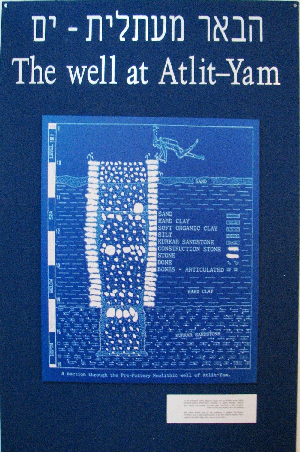
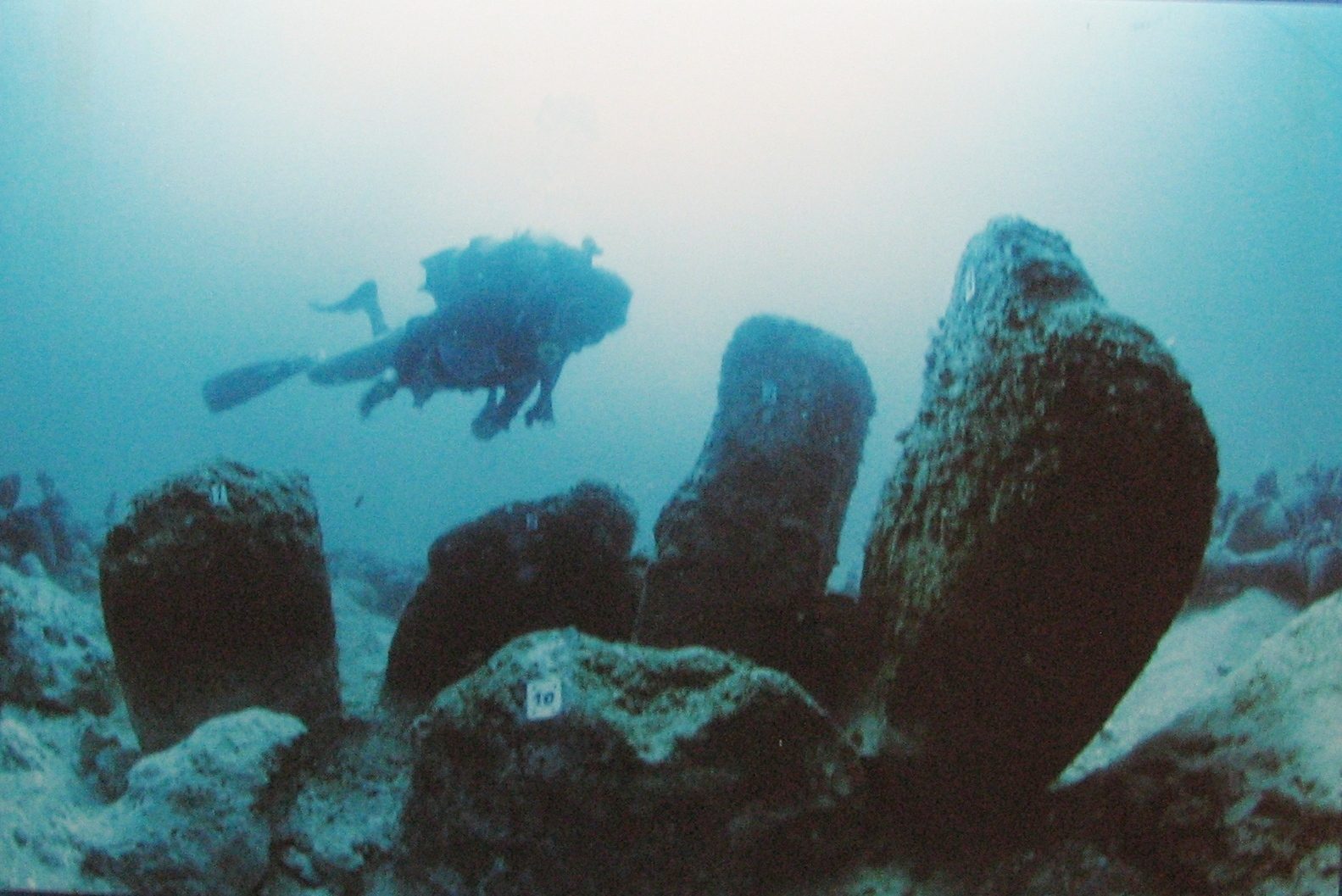
Atlit-Yam, off the Carmel coast of Israel in eight to twelve metres of water, is the one that should be famous and is not. It is a Pre-Pottery Neolithic C village dating to roughly 9,000 years ago, around 7000 BCE. It has stone-built houses, storage structures, one of the oldest known freshwater wells, and a megalithic stone semicircle that looks ceremonial. The organic preservation is extraordinary: flax, barley, wheat and lentils showing early agriculture, animal bone showing cattle, pigs and dogs, fish hooks and bone tools. It also holds the earliest known cases of tuberculosis, identified from M. tuberculosis DNA in the skeletons of a mother and infant. It went under as the Mediterranean rose between roughly 7000 and 6300 BCE, possibly hurried along by the Storegga tsunami.
Port Royal in Jamaica is the control experiment. It sank on 7 June 1692 in an earthquake that liquefied the ground under it, killing more than two thousand people, and it lies today in two to fifteen metres of water in Kingston Harbour. Because the date is documented, it tells us how a drowned town behaves: rapid burial in liquefied sand preserved buildings, streets and objects in place, including a watch stopped at 11:43 in the morning. Port Royal is the reason we know that submerged urban archaeology is legible at all. It is the baseline against which older, undated sites are read.
03Doggerland, The Country Under The North Sea
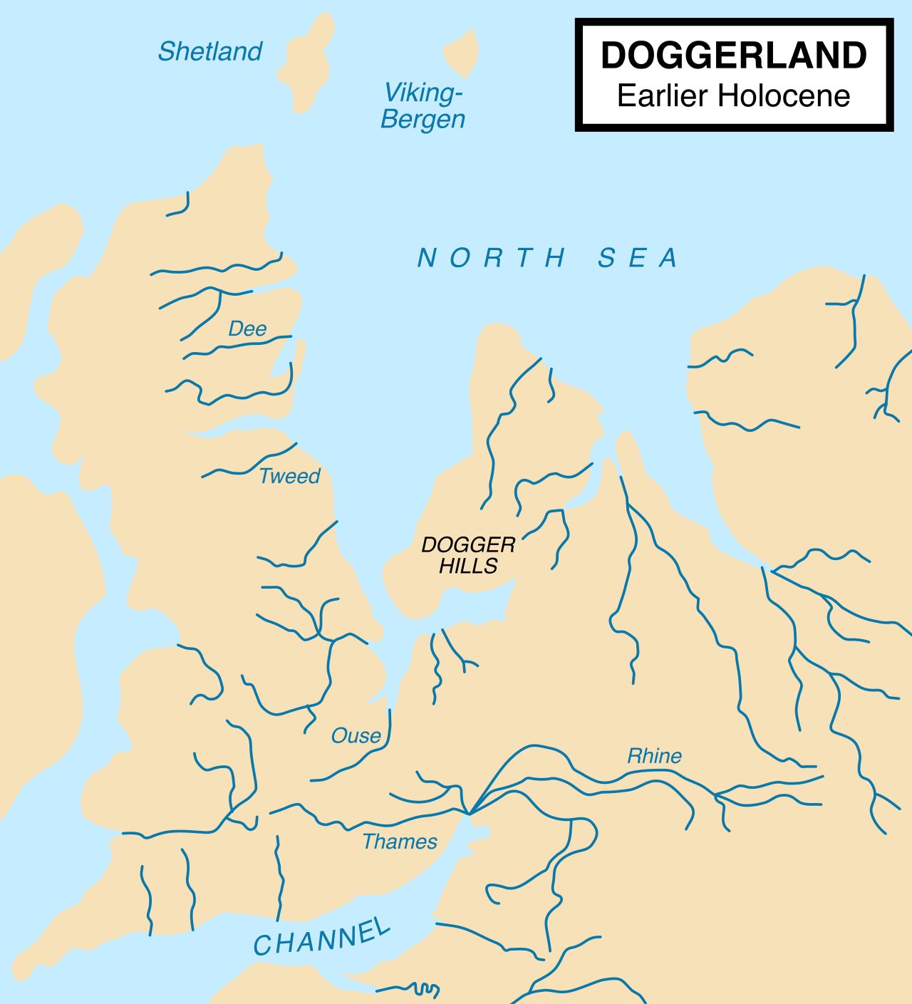
Between Britain and continental Europe there was land, and people lived on it. Doggerland covered around 23,000 square kilometres, larger than the Netherlands, and joined Britain to the mainland until roughly 6500 BCE. The evidence has been arriving by accident for over a century: fishing trawlers dredging up Mesolithic stone tools, bone harpoons, worked antler and human remains, including a Mesolithic skull. The Europe's Lost World project reconstructed the terrain in three dimensions from oil-industry seismic data, recovering ancient river systems, lake margins and coastlines. Animal remains recovered include mammoth, woolly rhino, elk and aurochs.
The final drowning of Doggerland was probably caused or accelerated by the Storegga Slide, a submarine landslide off Norway around 6200 BCE that generated tsunami waves of more than twenty metres. The evidence for the slide and the wave is solid; how decisive the wave was for Doggerland specifically, as opposed to a gradual inundation that the wave finished off, is the part still being argued in the literature. What is not in doubt is the direction of travel. Doggerland was not a marginal land bridge people hurried across. It was a resource-rich lowland at the centre of Mesolithic northwest Europe, and its loss pushed populations into Britain and Scandinavia.
04Sundaland, The Drowned Half Of Southeast Asia
Sundaland is the largest of the drowned lands in this file and the least discussed. At the Last Glacial Maximum the exposed continental shelf joined mainland Asia to Borneo, Java, Sumatra and the Philippines in a single landmass of roughly 1,800,000 square kilometres, larger than the Southeast Asia that is above water today. It was not a barren land bridge. It carried lowland savanna and forest and major river systems, and the archaeological and genetic evidence indicates Southeast Asia was a significant population centre through the Pleistocene. The Hoabinhian stone tool tradition, found across the region today, has its origins in that now-submerged landscape.
Stephen Oppenheimer argued in Eden in the East in 1998 that the flooding of Sundaland between roughly 14,000 and 5000 BCE drove population dispersals outward into island Southeast Asia, into the Pacific, and possibly as far as Madagascar, and that the region's flood traditions carry the memory. The dispersal argument is well grounded and has genetic support. The stronger form of the thesis, in which Sundaland functions as a source of civilisation rather than a source of people, goes further than the evidence, and it is worth keeping those two claims apart. Sundaland is also the most plausible homeland proposed for the Naga traditions that run through the region's mythology, though that connection remains a reading rather than a finding.
05Dwarka, Where Verified Meets Contested
Dwarka is the useful case, because within a single story you can watch a claim pass and a claim fail, and see exactly where the line sits.
Off Dwarka and Bet Dwarka in Gujarat, in five to twelve metres of water, there are genuine archaeological remains. India's National Institute of Oceanography ran marine surveys from 1983 to 2005 and recorded stone walls, bastions, anchors and pottery, along with a jetty or wharf structure confirmed by later survey. The pottery dates Late Harappan to post-Harappan, roughly 1500 to 1000 BCE. Something was built there, it was coastal, and the sea has it now. That much is real archaeology.
Two further claims are attached to it and neither is carried by the evidence. The first is the identification of the site with the legendary Dwarka of Krishna in the Mahabharata, which is interpretation rather than a finding: the structures are real, the name attached to them is a reading. The second is the Gulf of Cambay claim of 2001, in which NIOT side-scan sonar detected geometric features at 20 to 40 metres depth that were announced as a 9,500-year-old city predating the Indus Valley Civilisation by four thousand years. That claim has serious problems. The sonar data has not been independently verified in peer-reviewed geological literature. Geologists including Rajendran and Rajendran argued in 2003 that the features are natural. The famous radiocarbon date came from a piece of wood, and a date on wood tells you about the wood, not about a structure, particularly in a gulf with tidal currents strong enough to move material a long way. The site was dredged rather than excavated, and dredging destroys the context that would settle it.
How To Tell A Drowned Town From A Rock
- Plan
- Real settlements show street lines, repeated building outlines and enclosed spaces that connect. Pavlopetri has a readable town plan.
- Portable finds
- Pottery, tools, anchors, hooks, bone. Objects people carried and dropped. Atlit-Yam has fish hooks and lentils.
- Working stone
- Tool marks, mortar, dressed faces, inscriptions. Yonaguni has produced none of these.
- Dating the structure
- A date must come from the structure or its deposits, not from loose material nearby. This is where the Gulf of Cambay wood sample fails.
- Depth honesty
- Post-glacial rise gives you about 130 metres maximum. Anything much deeper needs tectonic subsidence, and that has to be independently shown.
- A natural explanation ruled out
- Layered sedimentary rock fractures at right angles on its own. That has to be excluded before 'built' is on the table.
06Yonaguni, The One Everybody Has Seen
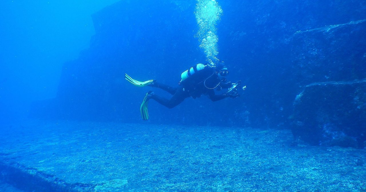
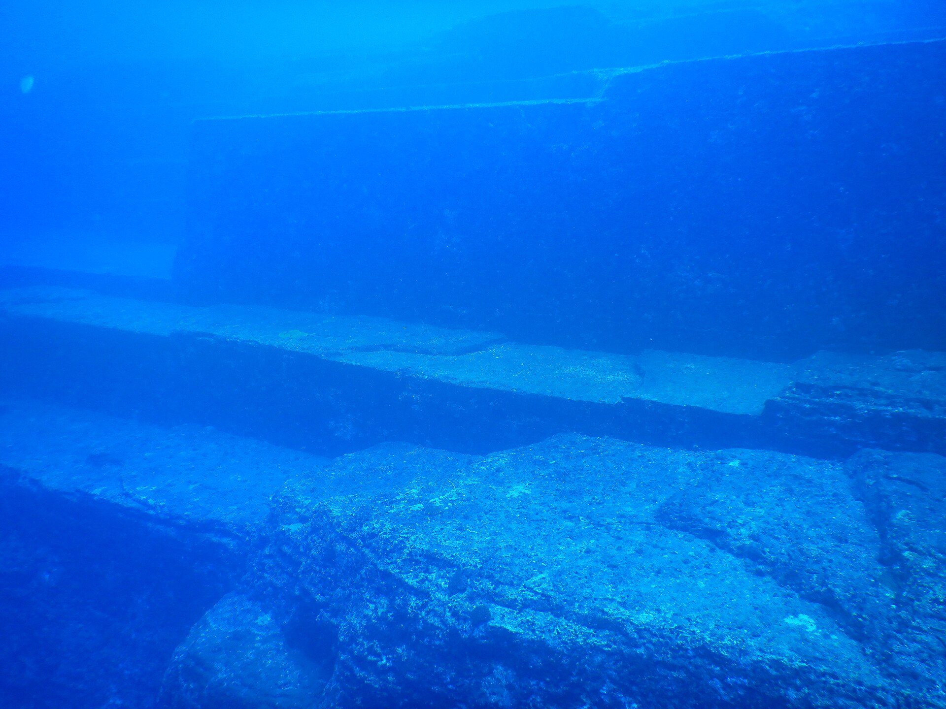
The Yonaguni Monument, off the Ryukyu island of the same name in five to twenty-five metres of water, was found by the diver Kihachiro Aratake in 1987 and has been the most photographed underwater mystery ever since. Masaaki Kimura has argued across published diving surveys that it is artificial, pointing to right-angled terraces, flat platforms, apparent stairways, two pillar-like features, a channel he reads as a roadway, an enclosure he compares to a stadium, and a shape nicknamed the turtle. He dates construction to around 10,000 years ago on the basis of when the site was last above water. If he is right, it implies an organised stone-working culture in late Pleistocene Japan.
The mainstream geological reading is that the monument is natural, and it is a strong reading. Yonaguni's bedrock is mudstone and sandstone that fractures along bedding planes and joints at close to right angles, which produces exactly the flat terraces, sharp steps and clean edges that make the site look built. Rock formations on Yonaguni above the waterline show the same step-like fracturing, which is difficult to argue around. And the diagnostic evidence for human work is missing: no tool marks, no mortar, no carved inscriptions have been found. Robert Schoch, initially sympathetic to the artificial reading, later acknowledged the strength of the natural-formation case while noting that a few features remain awkward to explain.
The fair summary is narrower than either camp would like. The monument's most striking features, the terraces and steps and flat faces, are all consistent with known geological processes in layered sedimentary rock, and that is where the weight of evidence sits. A small number of features, including a possible carved channel and a triangular depression, are still debated. 'Mostly natural, with some details unresolved' is a less satisfying sentence than either 'ancient pyramid' or 'just rocks', and it is the one the evidence supports.
07Bimini Road, And What A Real Debunking Looks Like
The Bimini Road, found in 1968 off North Bimini in the Bahamas in three to nine metres of water, is a roughly 600-metre line of large rectangular limestone blocks. It became famous because Edgar Cayce had prophesied in 1938 that Atlantis would be found near Bimini, and the timing was irresistible. Proponents including David Zink argued the blocks were deliberately placed as a road, wall or harbour work, citing apparent tongue-and-groove joints and the regularity of the alignment.
It is beachrock, and this is about as cleanly settled as anything in this field gets. McKusick and Shinn published the case in Nature in 1980: the blocks are naturally cemented coastal sand, radiocarbon dated to roughly 2,000 to 3,500 years old, which is far too young for any ice-age civilisation and in fact younger than Pavlopetri. The undersides show no foundation preparation. Identical beachrock formations occur elsewhere in the Bahamas. The tongue-and-groove joints are ordinary weathering patterns in beachrock. Shinn returned to it with a detailed geological study in 2004 showing the blocks fractured in place from a single slab, which is why they line up: they were never moved at all.
08The Cuban Anomaly And The Depth Problem
In 2001 a survey by Advanced Digital Communications, led by Paulina Zelitsky and Paul Weinzweig, reported side-scan sonar and ROV imagery of apparent geometric structures off the Guanahacabibes Peninsula in western Cuba, described as resembling pyramids, rectangles and roads. National Geographic covered it in 2002 and funded follow-up work that proved inconclusive. No peer-reviewed geological or archaeological survey has since confirmed artificial structures, and no artefacts or cultural material have been recovered.
The difficulty is the depth, and it is not a matter of opinion. The site sits at roughly 600 to 750 metres. Post-glacial sea-level rise accounts for about 130 metres at the outside. To have been built on dry land, the site would need to have been lowered several hundred metres by tectonic subsidence, which would put its construction well beyond 50,000 years ago and therefore before any known human civilisation by tens of thousands of years. That is not impossible in principle, but it is an extraordinary claim that requires its own independent geological evidence, and that evidence has not been produced. Sonar at that depth is also entirely capable of rendering natural features as clean geometry.
09Nan Madol, The Cautionary Tale
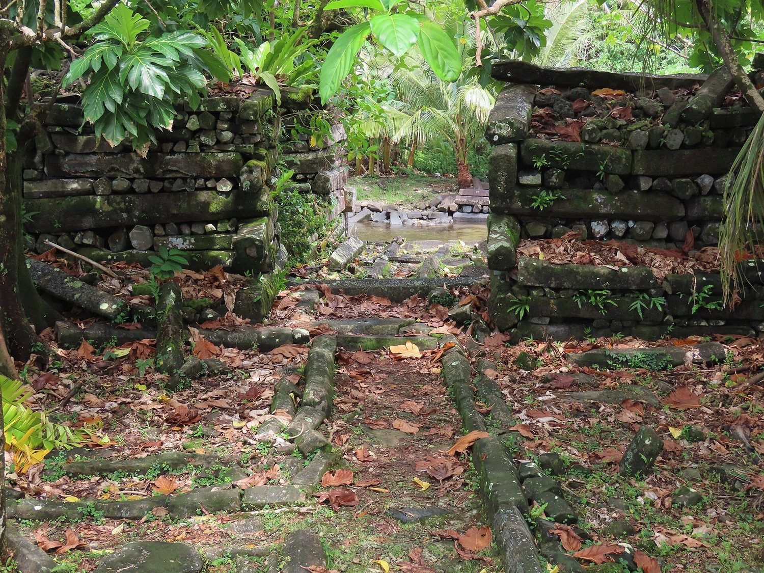
Nan Madol on Pohnpei in Micronesia is not a drowned city, though parts of it are now partly submerged, and it belongs in this file for a different reason. It is ninety-two artificial islands built out onto a coral reef flat, covering around eighty hectares, constructed from naturally formed prismatic basalt columns stacked like logs. The estimated mass moved is 750,000 metric tonnes, from quarries up to fifty kilometres away. The Nandowas tomb has walls up to 7.6 metres high. Radiocarbon dating puts the start of monument building around 1100 CE, with peak construction between roughly 1200 and 1500 CE. It has been a UNESCO World Heritage Site since 2016, and is also on the in-danger list.
The relevant fact is that an island population estimated around 25,000 people moved three quarters of a million tonnes of basalt without metal tools, wheels or draft animals. Local oral tradition says the twin sorcerers Olisihpa and Olosohpa flew the stones into place by magic, which is precisely the kind of tradition that gets cited as evidence of lost technology. It is not. Nan Madol is documented, dated, and unambiguously the work of the people whose descendants still live there. It is the standing refutation of the assumption that 'impossible' megalithic construction implies outside help, and it should be applied to every site in this file before anything more exotic is reached for.
10The Lost Civilisation Claim, Weighed Properly
The strong version, argued most prominently by Graham Hancock in Underworld in 2002 and by Randall Carlson and Robert Schoch in related work, holds that a sophisticated civilisation existed on the continental shelves before the ice age ended, that its drowning is the origin of the Atlantis story and of flood traditions worldwide, and that survivors seeded later cultures. The supporting arguments are the 25 million square kilometres of drowned land, the apparently abrupt arrival of Göbekli Tepe, the global spread of flood myths, and precessional astronomy in ancient cultures.
Each supporting argument has an answer. No artefacts of an advanced civilisation have been recovered from any submerged shelf, despite decades of offshore survey for oil, gas and telecommunications cable routes that has covered enormous areas of sea floor. Göbekli Tepe no longer appears from nowhere: nearby sites including Karahan Tepe and Boncuklu Tarla supply the precursors. Flood myths do not require a single global event, because coastal flooding was a widespread local reality for thousands of years. And the archaeological record as a whole shows gradual accumulation of complexity rather than an inheritance arriving fully formed.
There is a weaker version of the claim that survives the evidence comfortably, and it deserves saying clearly because it usually gets lost in the argument over the strong one. The proposition that the submerged shelves contain undiscovered archaeological sites is not speculative at all. It is close to certain. People lived on coasts, coasts drowned, and the sites went with them. Doggerland and Atlit-Yam are proof of concept. What is not supported is the further step to a civilisation comparable to later Bronze Age societies. The reasonable claim and the spectacular claim are routinely presented as the same claim, and they are not.
| Open question | Why it is still open |
|---|---|
| Have oil and gas seismic surveys been checked for archaeology? | Not systematically. Those surveys were designed to find geological structures, not small human ones, and the archaeological signal was never the target. |
| Can Sundaland occupation sites be found? | The Java Sea is shallow enough to survey, and Hoabinhian-era occupation is plausible, but no programme exists. |
| Will the Gulf of Cambay ever be resolved? | Only by proper excavation. Dredging cannot settle it and has already damaged the context. |
| How densely was Doggerland populated? | Current estimates may be low. New seismic data from North Sea wind farm surveys could revise it. |
| Is there a global shelf survey? | No. A systematic archaeological survey of the world's continental shelves between 0 and 130 metres does not exist. This is the largest unexplored archaeological frontier on Earth. |
11What The Traditions May Actually Remember
Aboriginal Australian oral traditions describe places that are now sea country, including locations off the present coast. Nunn and Reid argued in 2015 that some of these accounts preserve real coastline change from more than 7,000 years ago. If that reading holds, it is the longest-running accurate oral transmission documented anywhere, and it is a far more interesting finding than any drowned pyramid: it would mean speech alone carried a true geographic fact across roughly three hundred generations.
The Persian Gulf offers a similar possibility. Jeffrey Rose proposed in Current Anthropology in 2010 that the Gulf floor was an exposed, fertile valley during the ice age, watered by the Tigris, Euphrates, Karun and Wadi Batin, and that its flooding between roughly 8,000 and 6,000 years ago displaced its population. The supporting observation is that advanced Ubaid-period settlements appear rather abruptly around the Gulf rim around 7,500 years ago, which is what you would expect from people arriving from somewhere. If the hypothesis is right, the Mesopotamian flood narratives may sit on a real event, and the tradition of beings emerging from the sea to teach civilisation may be a memory of refugees rather than visitors.
What We Can Actually Stand Behind
Sea level rose about 120 to 130 metres after the Last Glacial Maximum, in pulses rather than evenly, drowning an estimated 25 million square kilometres. Pavlopetri, Heracleion, Atlit-Yam and Port Royal are real submerged settlements, surveyed and published. Doggerland, Sundaland, Beringia and the Sahul Shelf were inhabited land and are now sea floor. Nan Madol was built by Pohnpeians between roughly 1100 and 1500 CE. Bimini Road is natural beachrock, dated to 2,000 to 3,500 years old.
The Storegga tsunami around 6200 BCE contributed to the final loss of Doggerland. The Persian Gulf was a habitable basin whose flooding may underlie Mesopotamian flood tradition. Some Aboriginal Australian oral traditions appear to preserve real coastline change from more than 7,000 years ago, on Nunn and Reid's reading. Undiscovered archaeological sites almost certainly remain on the shelves.
The Yonaguni Monument as an artificial structure. The Gulf of Cambay sonar features as a 9,500-year-old city. The Cuban deep-water anomaly as anything built. The identification of the Dwarka remains with the Dwarka of the Mahabharata. A pre-ice-age civilisation comparable to later Bronze Age societies.
Bimini Road as an Atlantean construction, and the Cayce prophecy as evidence for anything. Underwater pyramid claims in the Bermuda Triangle, which rest on no credible sonar data. The Azores pyramid of 2013, which the Portuguese Navy investigated and found to be a natural volcanic seamount.
The sea did not hide a civilisation. It hid the coastlines, which is a much larger theft, because coastlines are where people actually live. Every estuary, every sheltered bay, every river mouth that a Mesolithic community would have chosen is now somewhere offshore under tens of metres of water, unsurveyed and unmapped for archaeology. That is the real story, and it does not need improving.
Sources & further reading
The research file at the top is where we worked from. It is our own claim, so it is not a check on us. Everything beneath it is where you can check us independently: the sea level and ice volume work, the excavation reports, and the Nature paper that settled the Bimini Road. One identifier carried by our own file resolved to a review of the book it named rather than the book, and it is not used here.
Image credits
- Yonaguni Monument, main terrace Melkov, via Wikimedia Commons. CC0 Source.
- Yonaguni Monument, main terrace Melkov, via Wikimedia Commons. CC0 Source.
- Post-glacial sea level rise curve Robert A. Rohde, via Wikimedia Commons. CC BY-SA 3.0 Source.
- Atlit-Yam, ritual structure made of stones Hanay, via Wikimedia Commons. CC BY-SA 3.0 Source.
- Atlit-Yam, the well Hanay, via Wikimedia Commons. CC BY-SA 3.0 Source.
- Doggerland reconstruction map Max Naylor, via Wikimedia Commons. CC BY-SA 3.0 Source.
- Nan Madol, Pohnpei Uhooep, via Wikimedia Commons. CC BY-SA 4.0 Source.
- Yonaguni Monument, terraces mid-part from the northwest Melkov, via Wikimedia Commons. CC0 Source.


