Sundaland: The Real Eden Under the South China Sea
Forget the invented continents. During the last ice age a warm, forested country stood above the water where the shallow seas of Southeast Asia are now, joining Borneo, Sumatra, Java, Bali, and the Malay Peninsula into a single landmass of roughly 1.8 million square kilometers. Then the post-ice-age seas rose and swallowed it whole. That much is settled geology, charted coastline by coastline. What is not settled is the bolder claim built on top of it: that a drowned Sundaland Eden seeded the farming, the flood myths, and the languages of half the world. This is the honest version of a sunken-continent story, the credible counterweight to Atlantis and Mu, with every fact wearing its tier.
Every drowned-continent story wants to be this one. Atlantis is a philosopher's parable and Mu is a Victorian invention, but Sundaland is a place you can map. During the last ice age a warm, forested country stood where the shallow seas of Southeast Asia are now, and the rising water took it, roughly 1.8 million square kilometers of it, inside the span of human memory. Its coastlines are charted, its rivers are traced, and its caves still hold the bones and the paintings of the people who lived there. That is the part that is real, and it is remarkable enough on its own. The part that is not settled is the bolder story some have hung on it: that this lost Eden was the cradle that seeded farming, flood myths, and the languages of half the world. Here is the file, every fact wearing its tier.
01The Shelf That Was A Continent
At the Last Glacial Maximum, between roughly 26,000 and 19,000 years ago, the sea stood about 120 to 130 meters lower than it does today, and the shallow Sunda continental shelf of Southeast Asia stood above the waterline. It was not an archipelago then. It was a single continuous landmass of roughly 1.8 million square kilometers that joined Borneo, Sumatra, Java, Bali, and the Malay Peninsula into one country, covered in tropical forest and drained by great rivers, among them a paleo-Sunda River whose catchment rivaled the modern Amazon, plus extensions of the Mekong and the Chao Phraya. In 2000 the biologist Harold Voris published the standard bathymetric reconstructions of these vanished coastlines, mapping how the shoreline retreated across the shelf at five-thousand-year intervals as the ice melted. This is not a legend. It is a charted landscape.
The drowning was not a slow, even creep. It came in pulses. As the great ice sheets collapsed, meltwater surged into the oceans in bursts that could put vast lowland plains under water within centuries, and in the worst episodes within a single human lifetime, until the flooding was substantially complete by roughly 6,000 to 5,000 years ago. This is the same global machinery, meltwater pulse after meltwater pulse, that drowned Doggerland under the North Sea at the other end of Eurasia. Our file on the Storegga Slide already lays out that pulse-by-pulse sea-level chronology in full for the North Sea case, so we will not re-derive it here; the Sunda Shelf went under by the identical process on a similar timetable.
02The Line That Splits The Animals
Sundaland has a hard eastern edge, and it was drawn by animals long before it was drawn by geologists. The Wallace Line marks the rim of the Sunda continental shelf itself. East of Borneo the seafloor drops into the Makassar Strait, a trench roughly 7,000 meters deep, so even at the ice-age lowstand of about 120 meters below present, no land bridge ever formed across it. The result is one of the sharpest faunal boundaries on Earth. West of the line the wildlife is Asian: tigers, rhinoceroses, primates. East of it, it turns Australasian: marsupials, cockatoos, birds of paradise. At its tightest, the strait between Bali and Lombok, the gap is only about 35 kilometers of water, and yet the animals on the two shores belong to different worlds.
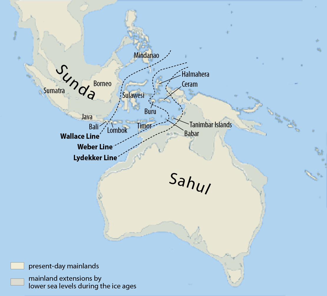
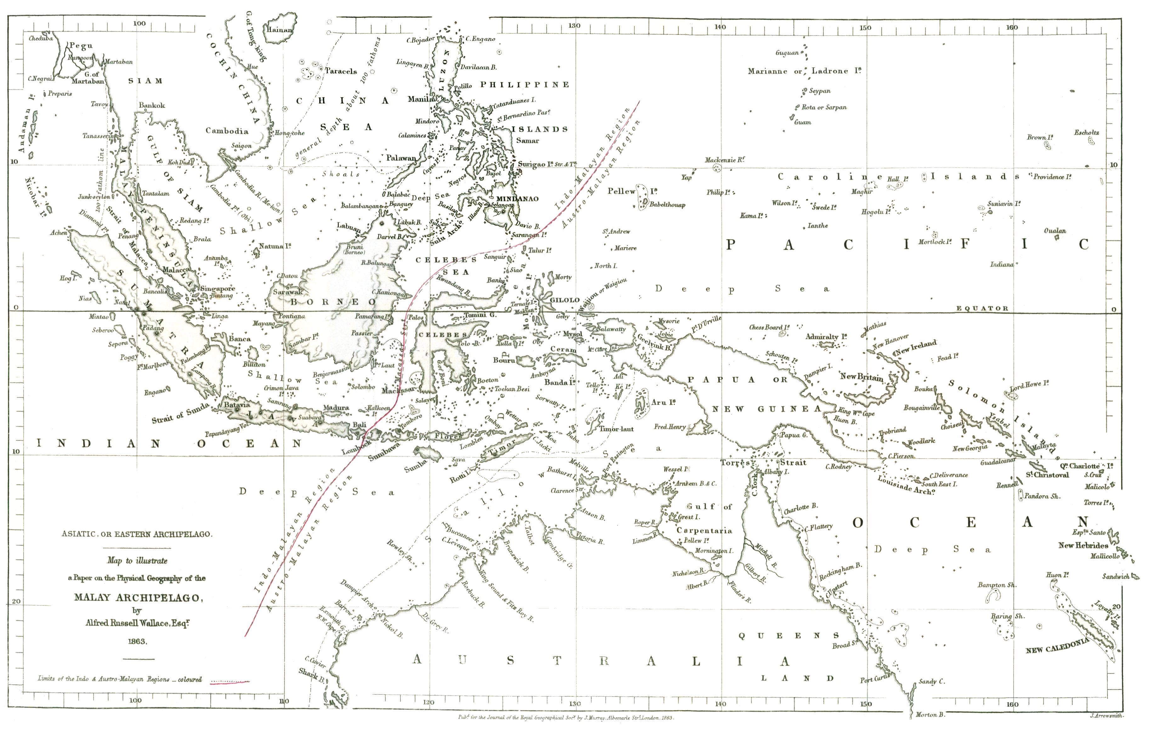
The line is named for the man who found it. Alfred Russel Wallace spent eight years, from 1854 to 1862, collecting specimens across the Malay Archipelago, and he noticed that a narrow strait could separate two utterly different animal kingdoms. Out of that fieldwork came The Malay Archipelago in 1869 and The Geographical Distribution of Animals in 1876, and out of those came the six great biogeographic realms, the Palaearctic, Nearctic, Neotropical, Afrotropical, Oriental, and Australian, that biologists still use to carve up the living world today.
The boundary is real, but it is not a single clean fence, and biologists have argued for over a century about exactly where to draw it. Between the Asian Sunda shelf and the Australian Sahul shelf lies a transitional zone called Wallacea, taking in Sulawesi, the Lesser Sunda Islands, and the Maluku Islands, where Asian and Australasian creatures overlap and a great many species live nowhere else. Later naturalists proposed their own lines through the same waters: Weber's Line, where Asian and Australian species reach a rough balance; Lydekker's Line, at the western edge of the Sahul shelf; Huxley's Line, a northward revision of Wallace's own. That the region needed so many lines is not a failure to define the boundary. It is a measure of how genuinely tangled the crossing between two continents really is.
| Line | What It Marks |
|---|---|
| Wallace Line | The eastern edge of the Sunda shelf, and the sharp Asian-to-Australasian faunal break |
| Weber's Line | Where Asian and Australian species reach roughly equal proportions |
| Lydekker's Line | The western edge of the Sahul (Australian) shelf |
| Huxley's Line | A northward revision of Wallace's original boundary |
03The People The Caves Still Hold
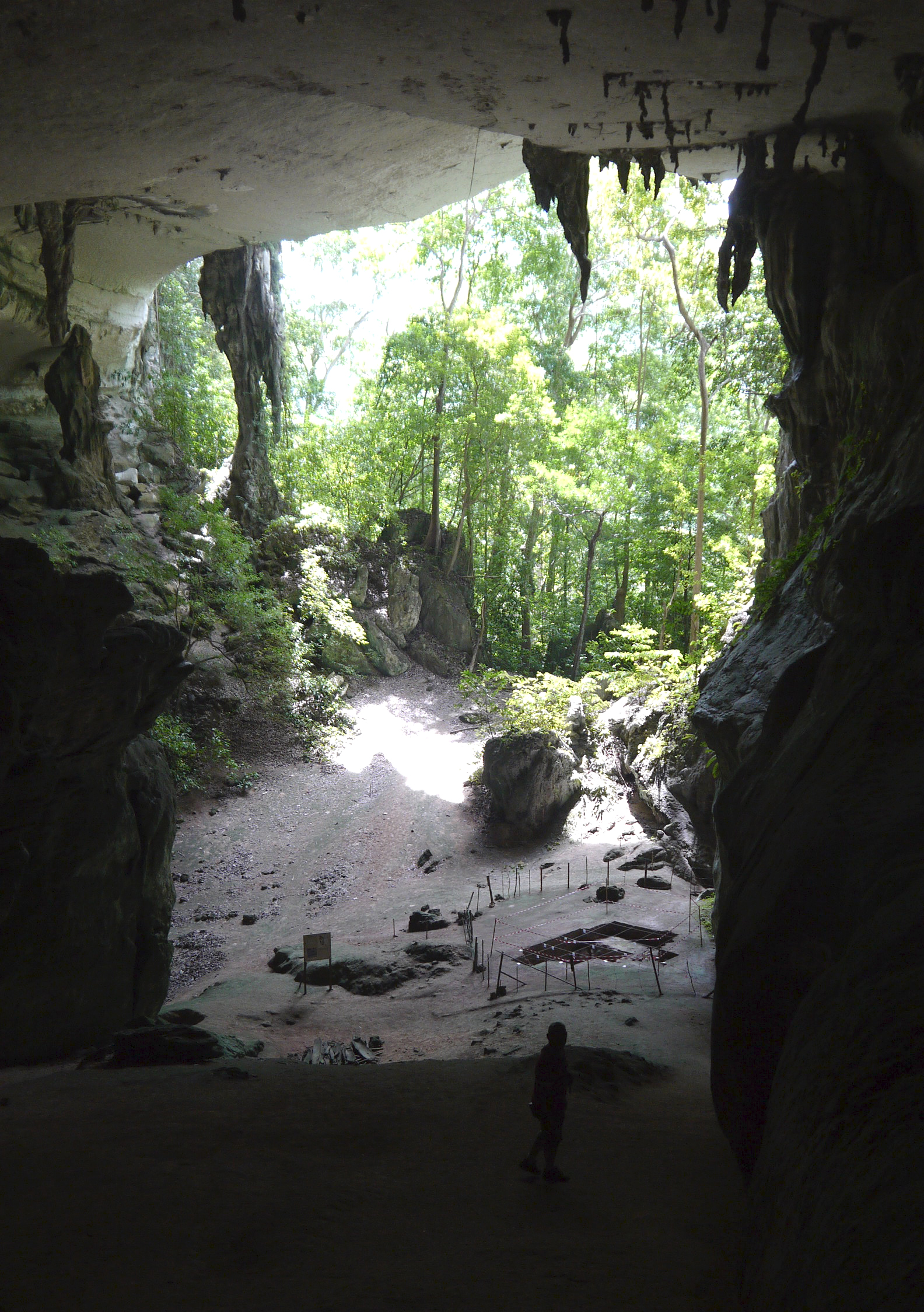
The human record on Sundaland is deep and physical, not inferred. At Niah Cave in Sarawak, on Borneo, excavators recovered the remains of anatomically modern humans dated to roughly 45,000 years ago, among the oldest confirmed Homo sapiens fossils anywhere in Southeast Asia. Stone tools from site after site across the shelf show that people lived here continuously through more than one glacial cycle. When the popular story reaches for a lost civilization, it walks straight past the genuinely astonishing thing: humans were living on this land tens of thousands of years before the first city rose anywhere on Earth.
The wider region reaches back further still. At Tam Pa Ling in Laos, modern human remains have been dated to roughly 63,000 years ago. And this was the launch coast for one of the boldest journeys in all of prehistory: the colonization of Sahul, the ice-age continent that joined Australia and New Guinea, by roughly 65,000 years ago. Reaching it meant deliberately crossing at least 60 to 90 kilometers of open ocean across the deep straits east of Sundaland, distances far beyond anything a person could survive by accident on a drifting log. Somebody meant to make that crossing.
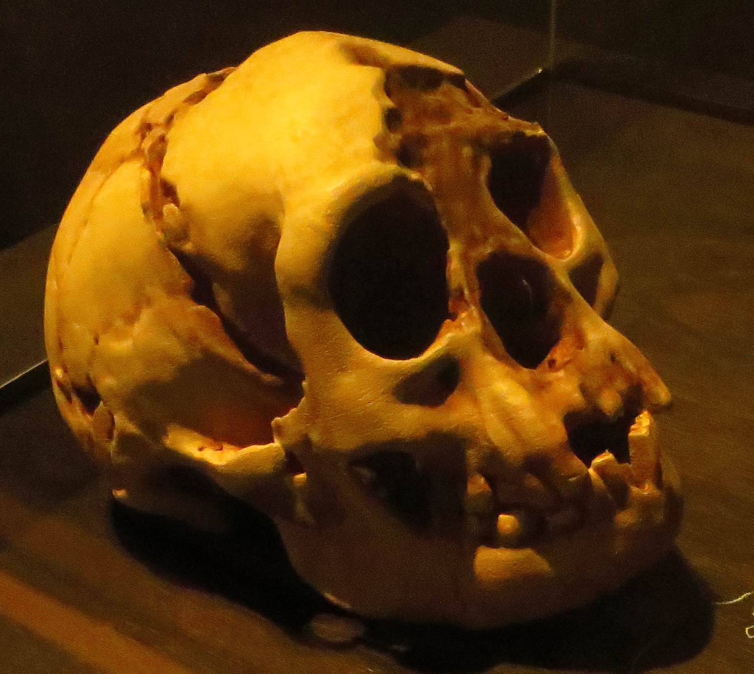
And Homo sapiens was not the only kind of human here. On Flores, just east of the Wallace Line, Peter Brown and Mike Morwood described Homo floresiensis in 2004: a hominin barely 1.06 meters tall with a brain of about 380 cubic centimeters, closer to Australopithecus than to us, its remains spanning roughly 100,000 to 60,000 years ago and its stone tools reaching to about 50,000 years ago. A cladistic analysis in 2017 confirmed it was a genuine, distinct hominin species and not a diseased modern human. Then in 2019 came Homo luzonensis, another small-bodied hominin, from Callao Cave in the Philippines at roughly 67,000 years ago. The Sundaland-to-Wallacea corridor was not one story of one species. It was a crossroads that held several kinds of human at once.
Older than any of them, Homo erectus reached Java at least 1.5 million years ago. The Sangiran dome in the Solo River basin has yielded more than 80 Homo erectus fossils, one of the richest concentrations of the species on Earth, and the youngest Javan specimens, from Ngandong, have been dated to roughly 117,000 to 108,000 years ago. That is an extraordinarily long tenure: Homo erectus very likely still walked the islands of the Sunda region while Homo sapiens was already alive elsewhere in the world.
Every one of these arrivals raises the same question: how did they cross the water? Flores and Sulawesi sit behind deep-water straits, some as narrow as about 19 kilometers at the tightest crossing but never dry, which means somebody was using watercraft, by at least a million years ago if Homo erectus itself reached Flores, and certainly by roughly 65,000 years ago for the people who reached Sahul. Robert Bednarik argued in 1999 that seaworthy rafts or boats must have existed by 60,000 to 65,000 years ago on the strength of the Sahul crossing alone. The hard evidence backs early seafaring: deep-sea tuna bones from Jerimalai Cave in Timor-Leste, dated to roughly 42,000 years ago, prove people were fishing well offshore, and the same site yielded fishhooks about 23,000 years old, among the oldest purpose-made fishing gear known anywhere. What we cannot prove, because organic boats simply do not survive in a tropical sea, is that this adds up to one long unbroken maritime tradition rather than a series of separate crossings. The dates are Tier 1. The continuous tradition is a credible inference, not a demonstrated fact.
| Find | Where | Age | What It Shows |
|---|---|---|---|
| Homo erectus (Sangiran, Ngandong) | Java | 1.5 million to about 108,000 years ago | Over 80 fossils; one of the longest hominin tenures on Earth |
| Homo floresiensis | Flores (Wallacea) | About 100,000 to 60,000 years ago | A distinct small-bodied hominin, confirmed 2017 |
| Homo luzonensis | Luzon, Philippines | About 67,000 years ago | A second endemic small-bodied hominin |
| Homo sapiens (Tam Pa Ling) | Laos | About 63,000 years ago | Very early modern humans in mainland Southeast Asia |
| Sahul crossing | Wallacean straits | About 65,000 years ago | Intentional 60 to 90 km open-ocean voyages |
| Homo sapiens (Niah Cave) | Borneo | About 45,000 years ago | Among the oldest modern human fossils in Southeast Asia |
| Jerimalai fishing | Timor-Leste | About 42,000 yrs (tuna); about 23,000 yrs (hooks) | Offshore deep-sea fishing and very early fishhooks |
04The Oldest Art On Earth
In 2021 a research team led by Adam Brumm and Maxime Aubert reported a painting of a Sulawesi warty pig on the wall of Leang Tedongnge cave, dated by the uranium-series method on the mineral crust growing over it to at least 45,500 years ago. It is the oldest known figurative image made by a human hand anywhere on the planet, older than the celebrated cave art of Ice Age Europe by roughly two thousand years. Two years earlier the same group had described a 4.5-meter panel at another Sulawesi cave, dated to at least 43,900 years ago, showing part-human, part-animal hunters closing on their prey, the oldest known narrative scene and the oldest known depiction of supernatural beings. The people of the Sunda region were not just present in deep time. They were painting stories on cave walls before anyone in Europe.
05What The Genes Actually Say
Turn from bones to blood, and Southeast Asia keeps its place at the center of the human story. The region carries some of the highest genetic diversity in the world in both maternal mitochondrial DNA and paternal Y-chromosome markers. Macrohaplogroup M, the mother lineage of most non-African mitochondrial DNA, is most diverse here. So is Y-chromosome haplogroup K and its descendants O, M, and S, which together account for more than half of every Eurasian and Oceanian man alive. In 2009 the HUGO Pan-Asian SNP Consortium confirmed the picture: Southeast Asia was a true genetic crossroads, exactly what you would expect from a place people had lived in and moved through for tens of thousands of years.
That diversity has been read as a founding signal. In 2005 Vincent Macaulay and colleagues sequenced complete mitochondrial genomes and argued for a single, fast coastal migration out of Africa, sweeping along the shore of South Asia and into Sundaland some 65,000 to 70,000 years ago, implying a large, long-settled population there deep in the Pleistocene. In 2008 Pedro Soares and colleagues, working from mitochondrial diversity, independently traced a genuine population expansion radiating outward from Sundaland beginning around 60,000 years ago.
Some of that ancient signal is still walking around. The Negrito peoples of the Philippines, Malaysia, and the Andaman Islands carry some of the oldest genetic lineages found anywhere outside Africa, consistent with descent from the early inhabitants of the Sundaland region, long before the later farming migrations swept through the same lands.
But the simple picture, an ancient hunter-gatherer stock replaced or overlaid by a single wave of farmers, did not survive contact with ancient DNA. In 2018 Hugh McColl and colleagues sequenced 26 ancient genomes from Southeast Asia and Japan, spanning the late Neolithic to the Iron Age, and found that living Southeast Asians descend from a mixture of at least four distinct ancient source populations. The old two-layer model, in which Pleistocene hunter-gatherers held the region alone until one mid-Holocene farming wave arrived from southern China, is too simple. The real history is layered: the original Hoabinhian hunter-gatherers absorbing several separate incoming streams tied to Austroasiatic, Kra-Dai, and Austronesian speakers over thousands of years. Any clean single-origin story for this region, including the simplest versions of the Eden hypothesis, has to answer to that messiness.
06Where The Languages Came From
The languages are where the deep past becomes almost tangible. The Austronesian family is the largest language family on Earth by number of distinct tongues, roughly 1,257 of them, spread across a span of the globe that runs from Madagascar to Easter Island and from Taiwan to New Zealand. Its great Neolithic expansion, generally dated to between about 5,500 and 3,000 years ago, moved by outrigger canoe and tacking sail, carrying taro, yam, banana, and breadfruit to island after island.
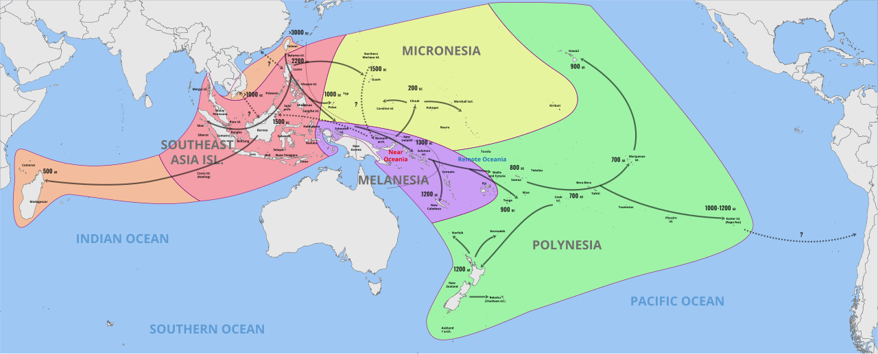
Where did that expansion begin? The mainstream answer is not Sundaland. The Out-of-Taiwan model, set out by Peter Bellwood in 1991 and Robert Blust in 1995, holds that the Austronesian languages originated in Taiwan around 5,500 years ago and spread south and outward from there, and in 2009 Russell Gray and colleagues confirmed a Taiwan origin at roughly 5,200 years ago using Bayesian analysis of the languages themselves. As Wikipedia's own current summary of the field puts it plainly, this Out-of-Taiwan model 'is accepted by the vast majority of professional researchers,' working inside a two-layer model in which incoming Neolithic Austronesian speakers assimilated, rather than simply replaced, the Paleolithic islanders already there.
And here a distinction matters that popular treatments love to blur. Not every Southeast Asian language family traces back to a drowned Sundaland homeland. Austronesian at least has such a theory attached to it, a genuine if minority one, which is Oppenheimer's, coming up next. Austroasiatic does not. That family, which includes Vietnamese, Khmer, and the Munda languages of India, has no Sundaland-origin theory in the current literature at all: the standard reconstructions place its homeland along the Yangtze River in southern China, with minority proposals pointing to the Red River Delta or the Brahmaputra basin, none of them on the Sunda Shelf. The genetics agree, tracing the Austroasiatic speakers who carried rice farming into mainland Southeast Asia back to southern China around 4,000 years ago. If you read that a lost Sundaland seeded the region's languages, hold onto exactly one thread of it, and even that one is contested.
07Eden In The East: The Claim Itself
Now the hypothesis this whole file circles. In 1998 the geneticist Stephen Oppenheimer published Eden in the East: The Drowned Continent of Southeast Asia, and made a genuinely bold argument. Sundaland, he proposed, had been the home of a sophisticated, maritime-adapted population that the rising seas drove out over thousands of years, and as they scattered they carried their culture with them, farming, pottery, and above all flood mythology, seeding mainland Asia, Taiwan, Melanesia, Polynesia, and perhaps India. In his reading the drowning of Sundaland was a demographic engine behind the great dispersals, the Austronesian expansion among them, and his genetic work traced lineages usually credited to mainland Asian or Near Eastern origins back to a Southeast Asian source instead. It is a serious, carefully argued book, and that is exactly why it deserves to be weighed with care rather than either dismissed out of hand or swallowed whole.
So how has it held up? Not as settled science. The geographic and genetic starting point, that Southeast Asia was a deep, diverse population reservoir, is taken seriously. But Oppenheimer's stronger claim, a Sundaland civilization whose flooding seeded the culture and languages of half the world, has not won the field. Wikipedia's own current article on Sundaland states it flatly: the 'Out of Sundaland' theory is 'an extreme minority view among professional archaeologists, linguists, and geneticists,' set directly against the Out-of-Taiwan model that 'is accepted by the vast majority.' The pushback is named and specific. Peter Bellwood, the very archaeologist whose Out-of-Taiwan work anchors the mainstream, has criticized Oppenheimer for reading a diffusionist story into sparse data in a way that echoes the old lost-continent myths, and for lacking the genetic evidence to pin the Austronesian expansions on a Sundaland source. And the deepest problem is simple: despite roughly two million square kilometers of shelf going under by about 6,000 BCE, no substantial pre-5,500-year-old remains, no tools, no settlements, no farming traces, have ever been recovered to show a sophisticated civilization was there, as opposed to the deep hunter-gatherer occupation that genuinely was. That absence is not proof it never existed. Its lowlands are, after all, now under the sea. But you cannot build a civilization out of missing evidence, and the honest tier here is credible-to-speculative, not fact.
08The Claims That Stay Underwater
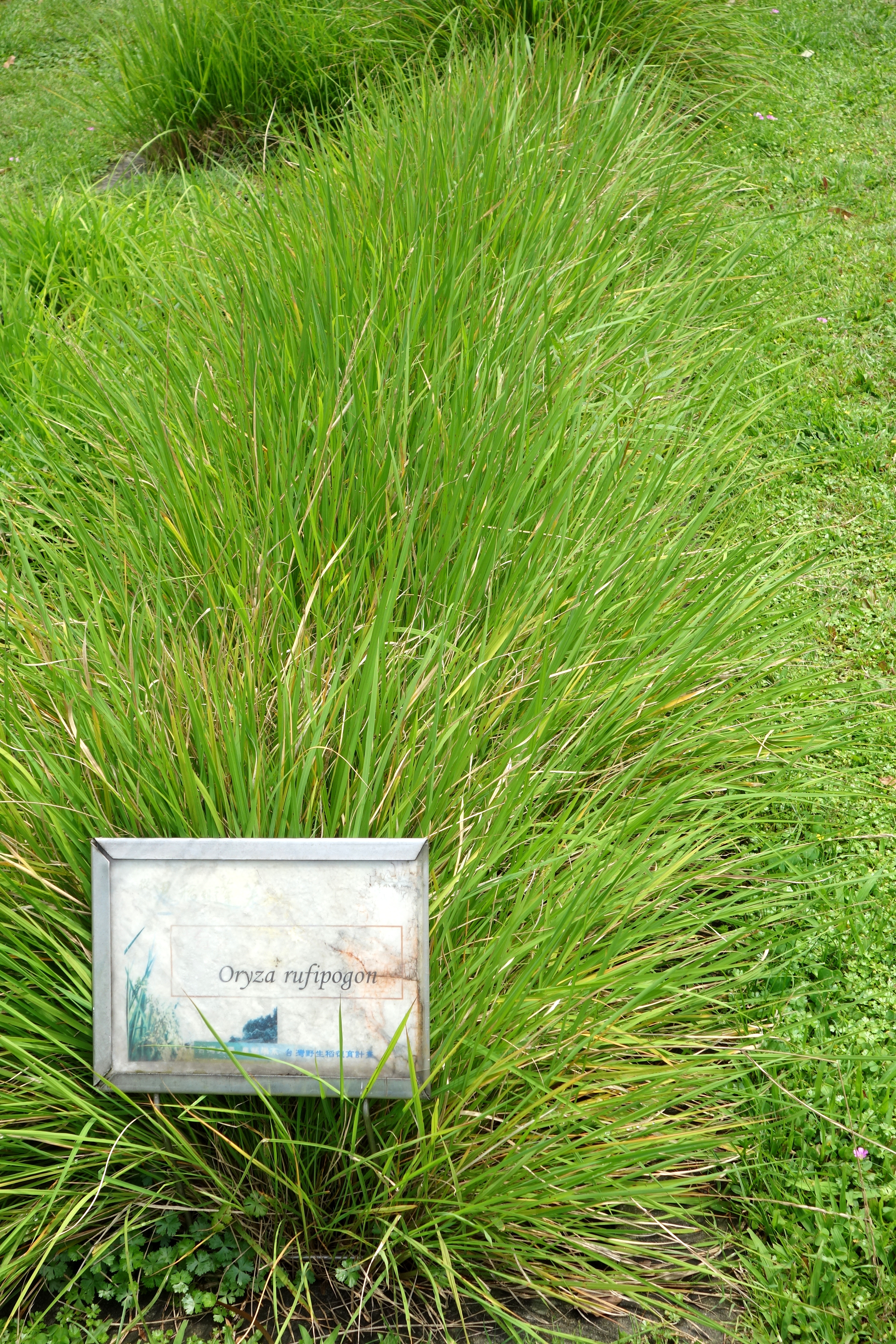
Some of the most tantalizing questions about Sundaland cannot be answered, because the ground that would answer them is now seabed. Take rice. Where Oryza sativa was first domesticated is genuinely debated, between the Yangtze Valley of China, roughly 9,000 to 13,500 years ago, and the lowlands of Southeast Asia. Some genetic work has suggested that indica rice was domesticated separately in South or Southeast Asia from the japonica rice of China. Wild rice, Oryza rufipogon, still grows in the wetlands and river margins of the region, so the people of pre-flood Sundaland would have had vast stands of it within reach. The earliest confirmed cultivation site on the Southeast Asian mainland, Khok Phanom Di in Thailand, dates to only about 4,000 years ago, well after the flooding, which could mean farming came late here, or simply that the older evidence is drowned.
The current genomics, though, leans the other way. Recent genome-scale studies increasingly favor a single origin over multiple independent domestications, placing the first cultivation of rice in the Yangtze basin roughly 8,200 to 13,500 years ago, with the indica gene pool arising later from wild populations around Indochina and the Brahmaputra through gene flow from japonica, rather than as a wholly separate domestication. That tips the balance further toward a China-first origin than the older even-handed 'still debated' framing suggests. The question is not closed, and some studies still support separate domestications, but the weight of current evidence leans away from an independent Sundaland cradle for rice, not toward one.
Then there are the flood stories. Oppenheimer catalogued more than a hundred flood myths across Southeast Asia, Oceania, South Asia, and East Asia, and argued that their shared bones, lowlands drowning, survivors saved on mountains or in boats, the world repeopled afterward, point back to real memories of post-glacial inundation. The Moken sea nomads of the Andaman Sea still tell of a drowned homeland they call Hup Kaday Hoi, described as strikingly close to Sundaland's real geography. And the general phenomenon is not fantasy: Aboriginal Australian oral traditions describing genuine sea-level change have been matched to geological events more than 7,000 years old, proving that human memory can carry the drowning of a coastline across hundreds of generations. What stays out of reach is the specific link. Matching any one Southeast Asian flood myth to any one Sundaland flooding event is, honestly, very hard to test.
09The Megaliths, And A Retracted Pyramid
Island Southeast Asia is dense with standing stones. Indonesia alone holds thousands of megalithic sites: the stone statues of Nias, the carved megaliths of Sulawesi, the stone-cist burials of Sumba, the towering figures of the Bada Valley in Central Sulawesi. Some researchers have wondered whether this whole megalithic tradition, which reaches on into Oceania and India, might trace back to a Sundaland cultural root, either invented there and carried outward or radiating from a shared base. It is a suggestive concentration. It is not a demonstrated origin, and this file keeps it firmly speculative, a question for future excavation rather than an answer.
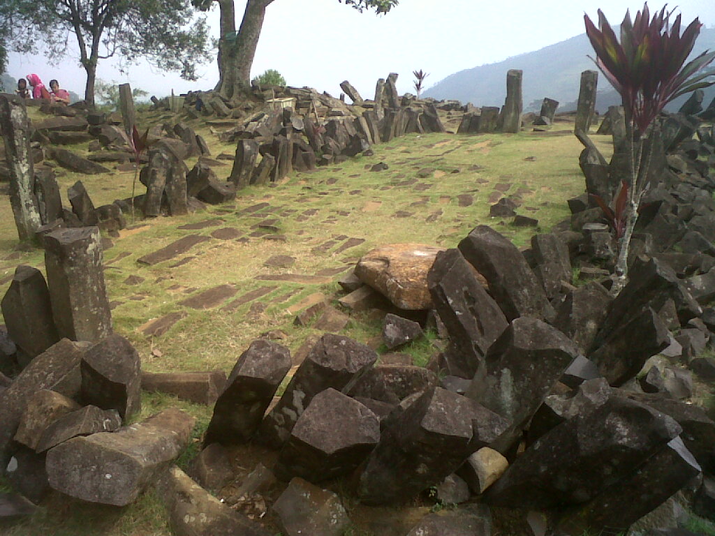
The most famous version of that idea has already collapsed. Gunung Padang, a real terraced megalithic site in West Java, was the subject of a 2023 paper in the journal Archaeological Prospection, in which Danny Hilman Natawidjaja and colleagues used ground-penetrating radar, seismic tomography, and core drilling to argue that construction layers buried beneath the visible terraces dated back as far as roughly 20,000 to 27,000 years ago, which would have made it the oldest pyramid on Earth by a staggering margin. Other researchers, among them Flint Dibble and Lutfi Yondri, argued that the deep dates came from natural soil and natural columnar rock, not from anything human-built. In 2024 the journal formally retracted the paper, citing peer-review irregularities and methodological problems. This matters, and this file flags it in plain sight: the buried-pyramid claim is withdrawn, not live. What remains genuine is narrower and real. The visible surface terraces of Gunung Padang are authentic megaliths, dated to roughly 2,000 to 5,000 BCE. It is only the far older buried structure said to lie beneath them that did not survive review.
10The Reach Across The Ocean
One piece of the Sundaland maritime story is not speculative at all, and it is astonishing. Around 1,500 years ago, Austronesian sailors crossed the entire Indian Ocean and settled Madagascar, off the coast of Africa. The proof is in the language: Malagasy is an Austronesian tongue, and its closest relative is the Barito group of southern Borneo, roughly 6,500 kilometers away across open water. Y-chromosome haplogroup O in Madagascar and the Comoros backs the connection, and in 2012 Murray Cox and colleagues found that the founding population may have been as small as about 30 Austronesian women, arriving by a direct or island-hopping crossing. This is real, documented, ocean-spanning reach by people descended from the Sunda region. What there is no evidence for is any earlier, Pleistocene-era crossing of that ocean. The deep drowned-Eden version of the story stops where the evidence does.
11The Counterweight, Held Honestly
And now the line this whole file has been walking toward. There is no archaeological support, none, for a technologically advanced civilization on Pleistocene Sundaland to rival Mesopotamia or Egypt. Every known site in the region shows hunter-gatherers or, at the most, early plant-tenders. Claims that satellite images reveal 'pyramids' or sunken 'cities' on the Sunda Shelf seafloor turn out to be natural geology or sonar-processing artifacts. The Yonaguni Monument off Japan, which sits well outside the Sunda Shelf anyway, is natural sandstone jointing, not masonry. As the underlying research puts it directly, alternative-history authors 'frequently cite Sundaland to lend scientific credibility to otherwise unsupported claims about pre-Ice Age global civilizations,' a move that distorts both the real archaeology and Oppenheimer's own more careful argument.
This is the distinction that makes Sundaland the honest one. As the research states plainly, 'claims that Sundaland was Atlantis or Mu confuse a real geological-archaeological question with fictional or esoteric geographical traditions,' and the popular habit of folding Sundaland into Atlantis 'misrepresents the actual scientific hypothesis, which concerns population dispersal and genetic diversity rather than lost advanced civilizations.' Set the three side by side and the difference is stark. Atlantis is Plato's literary invention, a moral fable with no independent geological referent. Mu and Lemuria are Victorian and occult inventions, built on a sunken-land-bridge idea that plate tectonics later destroyed. Sundaland is a bathymetrically mapped continental shelf with a real, dated archaeological record. A drowned country does not need to borrow a myth, and this one never did.
| Lost World | What It Started As | Physical Reality | Honest Verdict |
|---|---|---|---|
| Atlantis | Plato's dialogues, around 360 BCE | No independent geological or archaeological referent | A literary invention, most likely a fable |
| Mu and Lemuria | Victorian science, then occult elaboration | Built on a sunken land bridge that plate tectonics disproved | Invented continents that never existed |
| Sundaland | Bathymetric mapping and field archaeology | A real, dated, drowned continental shelf with a deep human record | Real geology; the Eden civilization claim stays a minority view |
Fast Facts
- The Place
- The Sunda continental shelf: Borneo, Sumatra, Java, Bali, and the Malay Peninsula, joined as one landmass
- Size
- Roughly 1.8 million square kilometers of dry land at the last ice age
- When It Drowned
- Flooded by post-glacial meltwater pulses, substantially gone by roughly 6,000 to 5,000 years ago
- Eastern Edge
- The Wallace Line, the deep-water rim of the shelf and a sharp faunal boundary
- Oldest Human Record
- Homo erectus on Java by 1.5 million years ago; modern humans at Niah Cave by about 45,000 years ago
- Oldest Figurative Art On Earth
- A Sulawesi warty pig painting, at least 45,500 years old
- The Hypothesis
- Oppenheimer's Eden in the East (1998), treated as an extreme minority view among specialists
- Language Consensus
- Austronesian traces to Out-of-Taiwan, not Sundaland; Austroasiatic to southern China
- Retracted
- The Gunung Padang buried-pyramid paper, withdrawn by its journal in 2024
- Not This
- Not Atlantis, not Mu, and not a Pleistocene advanced civilization
What We Can Actually Stand Behind
The Sunda Shelf was real. At the last ice age it was a single forested landmass of roughly 1.8 million square kilometers, mapped coastline by coastline, and the rising seas genuinely drowned it. Its deep human record is just as solid: Homo erectus on Java for well over a million years, Homo floresiensis and Homo luzonensis as separate hominin species, modern humans at Niah Cave by 45,000 years ago, and the oldest figurative art on Earth painted on a Sulawesi cave wall. All of that is settled.
Whether the drowning of Sundaland drove the great dispersals is a real research question, not a fantasy, and Oppenheimer's Eden in the East is a serious book. But its strong civilizational claim is an extreme minority view among archaeologists, linguists, and geneticists, with Peter Bellwood on record against it, and the 2018 ancient-DNA work shows a population history far messier than any single Sundaland origin. Rice most likely began in China's Yangtze, not here. The flood-myth and megalith links are suggestive and untestable. Nothing in this column is proven.
There was no advanced civilization on Pleistocene Sundaland. Not one wall, tool, or settlement of a sophisticated pre-5,500-year culture has ever been recovered from the shelf. The seafloor 'pyramids' and 'cities' are natural geology or sonar artifacts, Yonaguni is natural rock, and Gunung Padang's buried prehistoric pyramid was retracted by its own journal in 2024. And Sundaland is not Atlantis and not Mu. It is the real thing those inventions only pretend to be, which is a stranger and stronger fact than any of them.
So the honest verdict on Sundaland is the one the popular version never tells you: the land was real, the people were real, the drowning was real, and the advanced lost civilization was not. That is not a lesser story. A country larger than most nations on Earth today, lived in for tens of thousands of years and painted with the oldest art we have ever found, went under the warm shallow seas of Southeast Asia inside human memory, and its lowland heart is still down there, sealed beneath water we cannot easily dig. We may never know what those drowned plains held, because the one place the answer could be buried is the one place we cannot reach. If a farming village, or a shoreline settlement, or a single carved stone is ever pulled up from the floor of the Java Sea, which way would it tip the story?
Sources & further reading
Everything above is drawn from our research library on Theories of Anything, which is where we worked from. The papers, reports and primary records listed beneath them are where you can check us independently.
Image credits
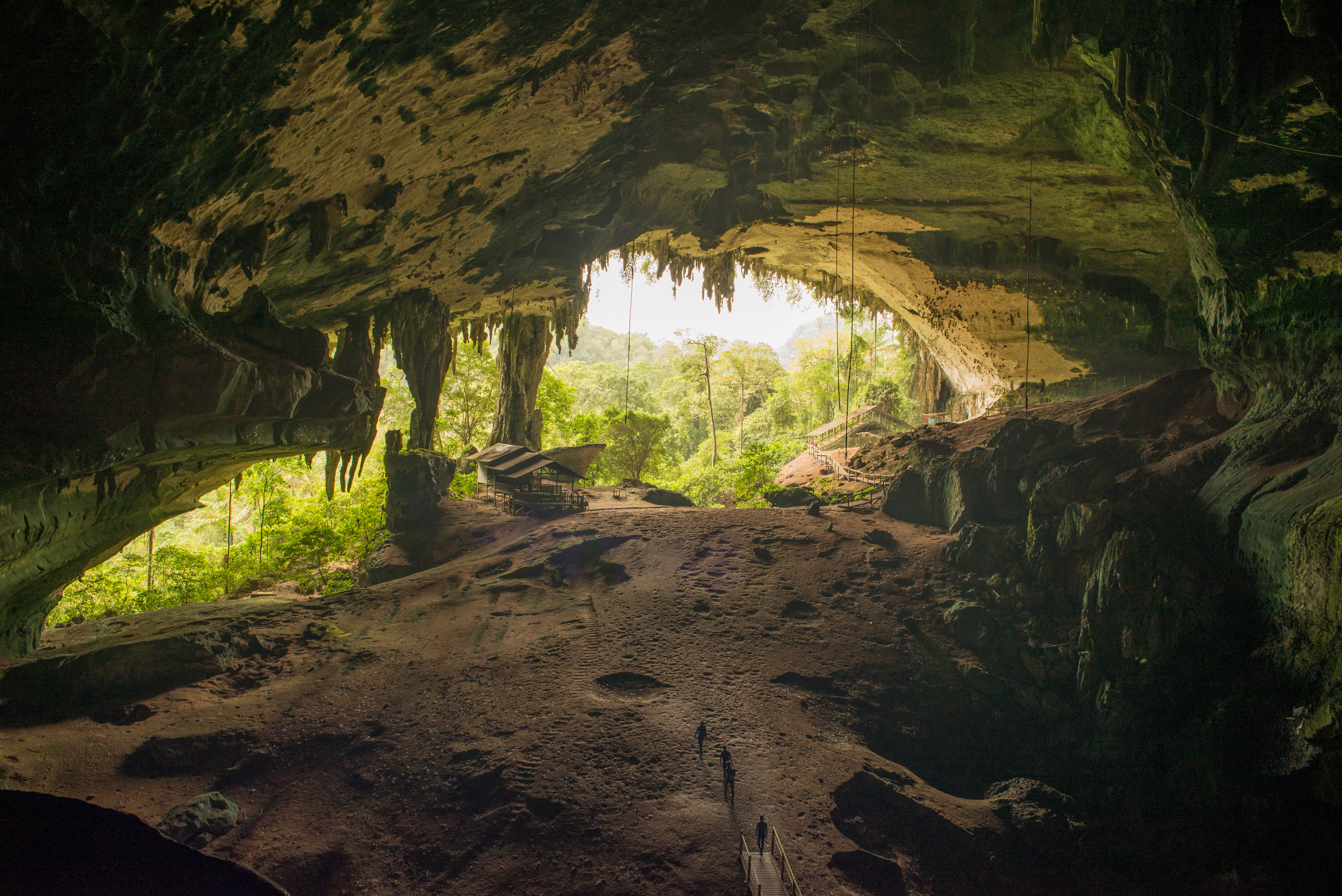
- The Great Cave, Niah National Park, Sarawak, Borneo photograph by Michael Elleray via Wikimedia Commons. CC BY 2.0 Source.
- Map of Sunda and Sahul with the Wallace, Lydekker, and Weber Lines map by Maximilian Dörrbecker via Wikimedia Commons. CC BY-SA 3.0 Source.
- Alfred Russel Wallace's Original 1863 Line Map drawn by Alfred Russel Wallace and J. Arrowsmith via Wikimedia Commons. Public Domain Source.
- Homo floresiensis Skull, Royal Belgian Institute of Natural Sciences photograph by Ghedoghedo via Wikimedia Commons. CC BY-SA 4.0 Source.
- Gunung Padang Megalithic Site, West Java photograph by Mohammad Fadli via Wikimedia Commons. CC BY-SA 3.0 Source.
- Chronological Dispersal of Austronesian Peoples Across the Pacific map by Pavljenko via Wikimedia Commons. CC BY-SA 4.0 Source.
- The Painted Cave (Kain Hitam), Niah National Park photograph by Azreey via Wikimedia Commons. CC BY-SA 3.0 Source.
- Wild Rice (Oryza rufipogon) photograph by Daderot via Wikimedia Commons. CC0 1.0 Source.
- Card crop of The Great Cave, Niah National Park, Sarawak, Borneo photograph by Michael Elleray via Wikimedia Commons. CC BY 2.0 Source.


